Clitheroe
Clitheroe is about 15 miles northeast of Preston, and Wiki tells me is considered one of the best places to live in the UK based on surveys in the Sunday Times.
The town is dominated by a castle, which is situated at the top of a rocky hill - the name Clitheroe is Anglo-Saxon for rocky hill - overlooking the River Ribble, which passes Clithoe on the northeast.
The Castle
The castle can be explored for free.
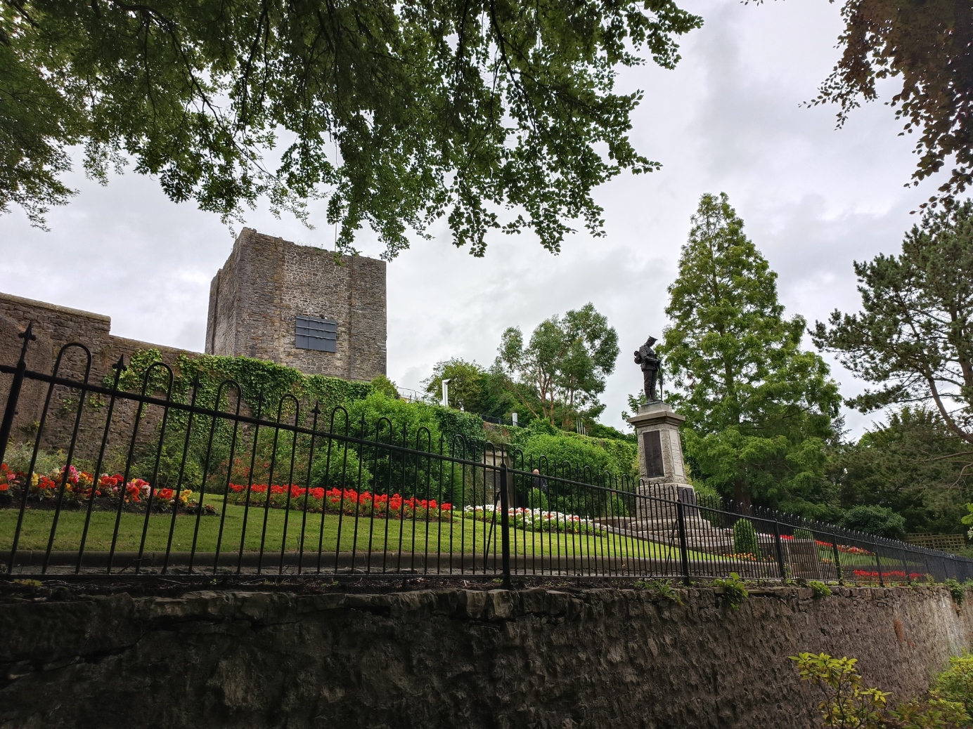
On the highest point is the Norman keep, one of the smallest in England.

The keep is a ruin, but not in terrible shape. However, there is not much to see inside. No interior floors are surviving besides the stone floor of the basement.
The tower is surrounded for much of its perimeter by a lower wall, which is in good repair, and can be accessed for good view of the area.

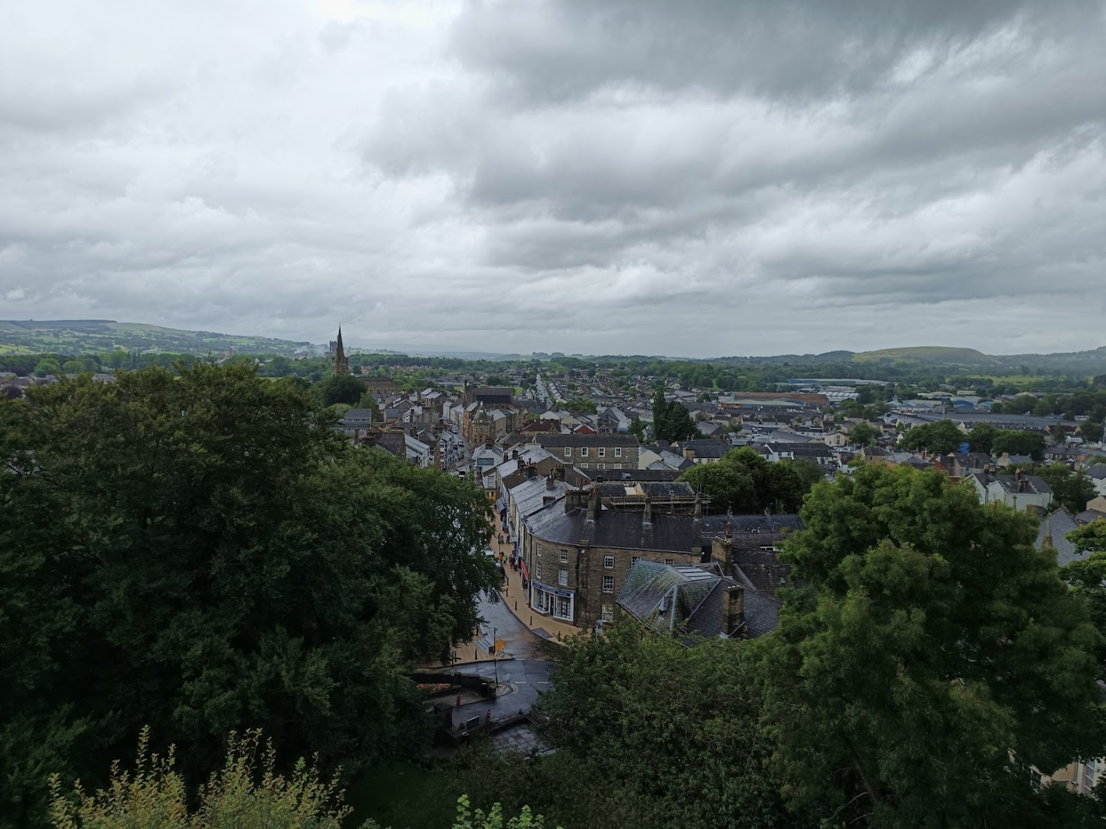
Looking northwest, more-or-less along the main street.
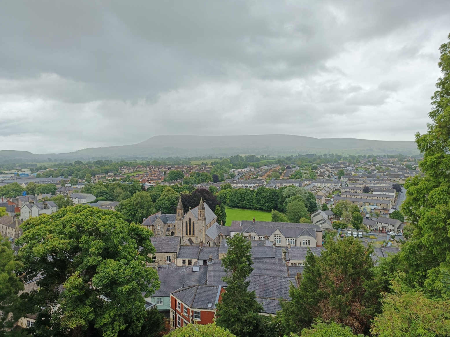
And southeast towards Pendle Hill.
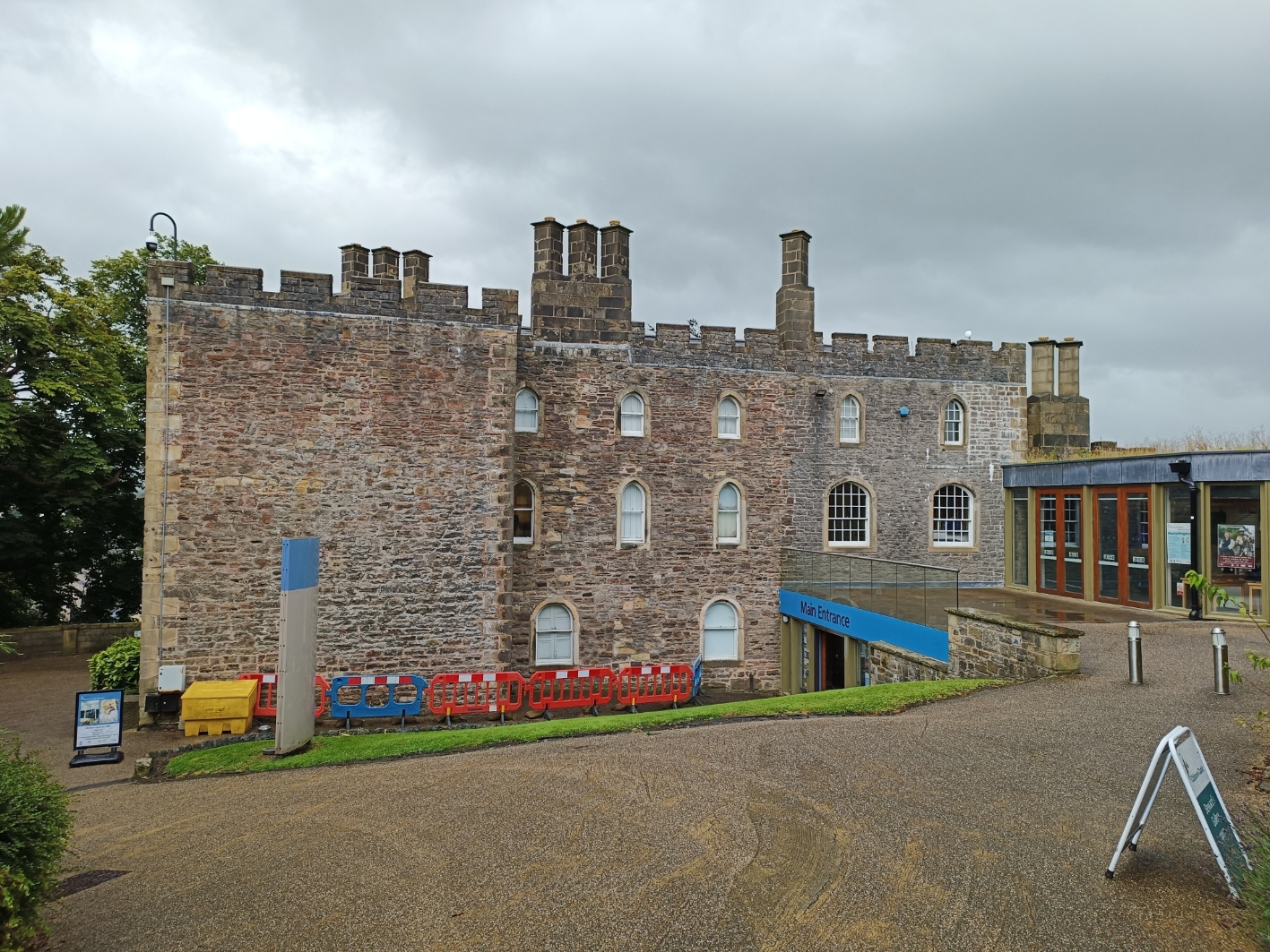
The castle was extended to the south and southwest, but most of this has now gone. There are buildings there, but they mostly date to the eighteenth century. The building below is now a museum.
The castle was sold to the people of Clitheroe in 1920 to create a war memorial.
The Town
To the south of the castle is a pub, the Brown Cow, wedged in between Moor Lane and (behind it) Woone Lane, which will be our starting point.

On the other side of the road, more or less behind me when I took that photo, is the Emporium. This seems to be both a pub and a cafe, and is an impressive building that used to be a chapel.

Moor Lane continues northward, curving and rising up to the castle gate.
Passing the United Reformed Church.

At the top, the castle gate is on the left and Castle Street on the right, and Moor Lane becomes Parson Lane.
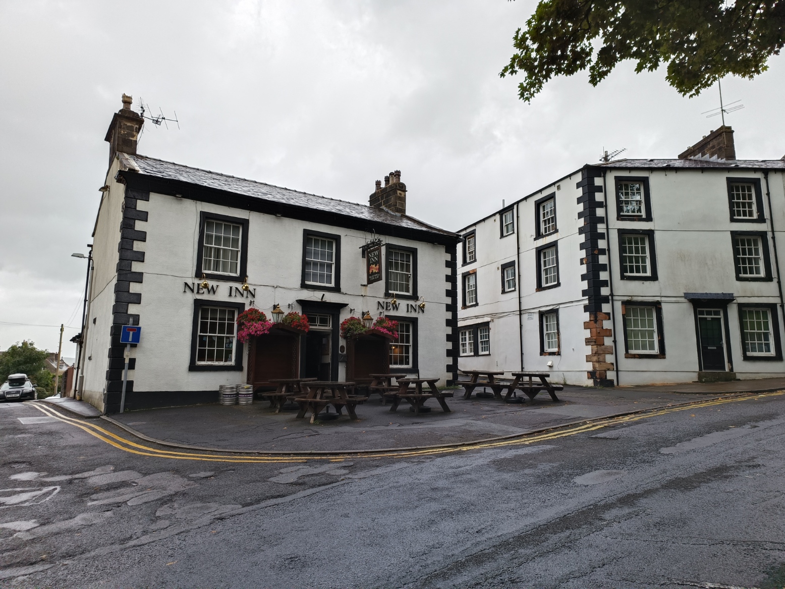
At the bottom of Parson Lane is the New Inn.
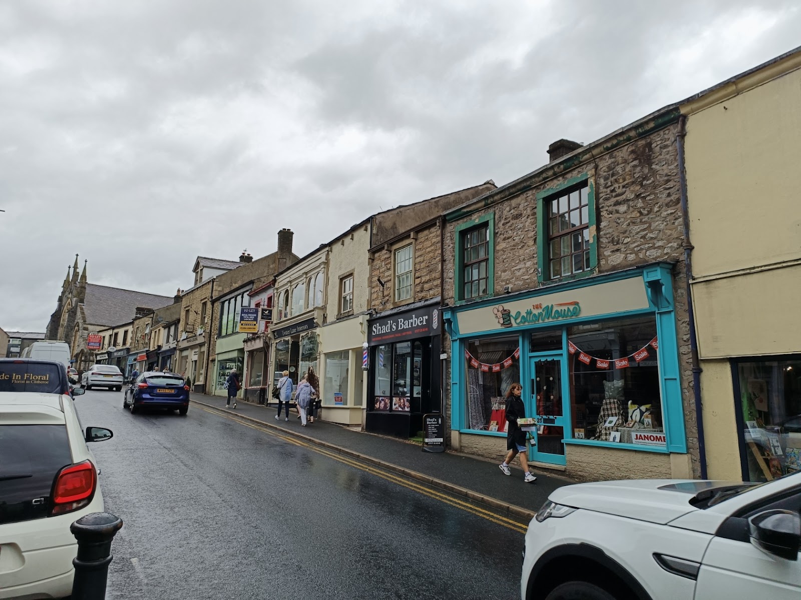
Back to Castle Street, and this is the Clitheroe high street. This is the view a short way along, looking back towards the castle.

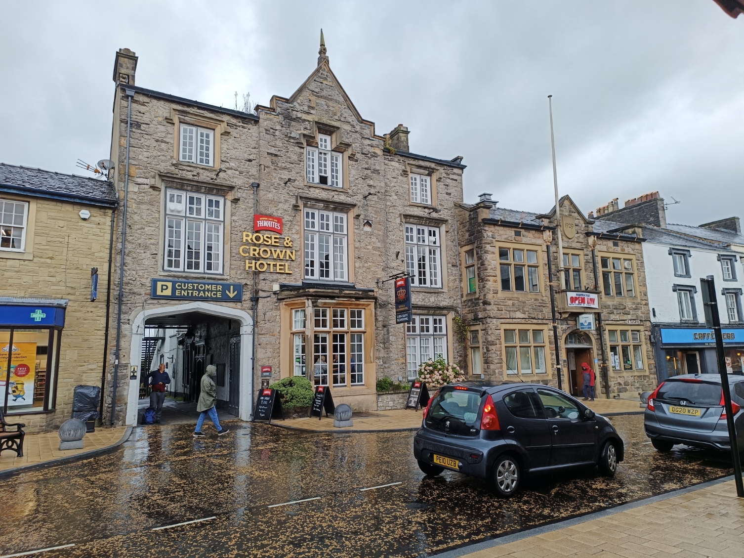
On the left is the Rose and Crown.
And on the right the Swan and Royal.

You get the feeling the town wanted to be clear is was on the side of the Royalists in the Civil War! Behind the swan is a pleasant courtyard.

Further down Castle Street is the White Lion.

The road splits into Church Street (on the left) and York Street, with a library tucked in between them.

Church Street leads up, of course, to the church. There has been a church here since Norman times, and possibly earlier, but the present structure dates from 1829, though it was substantially rebuilt, after a fire, in 1981, and the spire rebuilt in 2012.

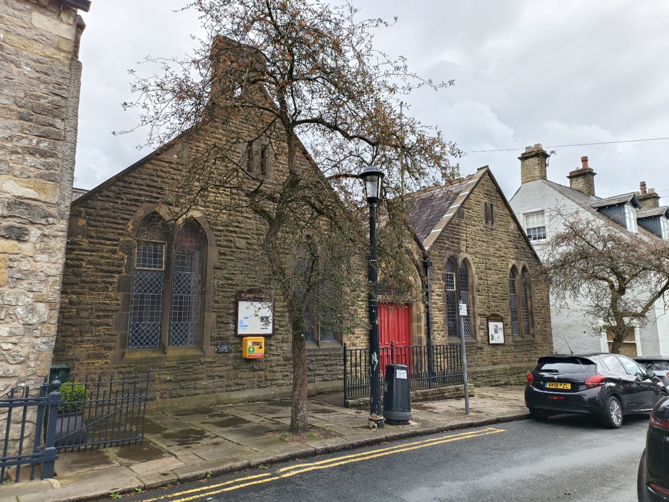
On the way to the church there is the St Mary's Centre, which is a community centre, but must surely have been associated with the church originally.
Church Street becomes Church Brow as it passes the church and descends quite rapidly to Well Terrace, which makes its name from the nearby well. No sign of the water now!

Continuing along that road we find another royal pub, this is the Royal Oak.

One final photo, this is a view of Clitheroe from Nick of Pendle - a gap between Pendle Hill and an adjacent hill.


Comments
Post a Comment