West Lancashire Railway
Not to be confused with the West Lancashire Light Railway, a heritage narrow-gauge railway in Tarleton.
The West Lancashire Railway was set up to connect Preston and Southport, and had its own terminus at each end. It closed in 1964, and very little remains of the route, and this page tries to catalogue what can still be seen. For photos of it when it was still a railway, here is a good place to start.
Preston
It started at Fishergate Hill station, at the bottom of Fishergate Hill, Preston. the station opened in 1882, and closed to passengers just 20 years later, when the railway was taken over by Lancashire and Yorkshire Railway, with trains then using the L&Y main station at the top of the hill. It remained as a goods depot until 1965, but has now been demolished, and even the embankment it was on has gone. The south end is not a park, allowing the space where the station was to be made out.

The north end has disappeared under houses and shops.
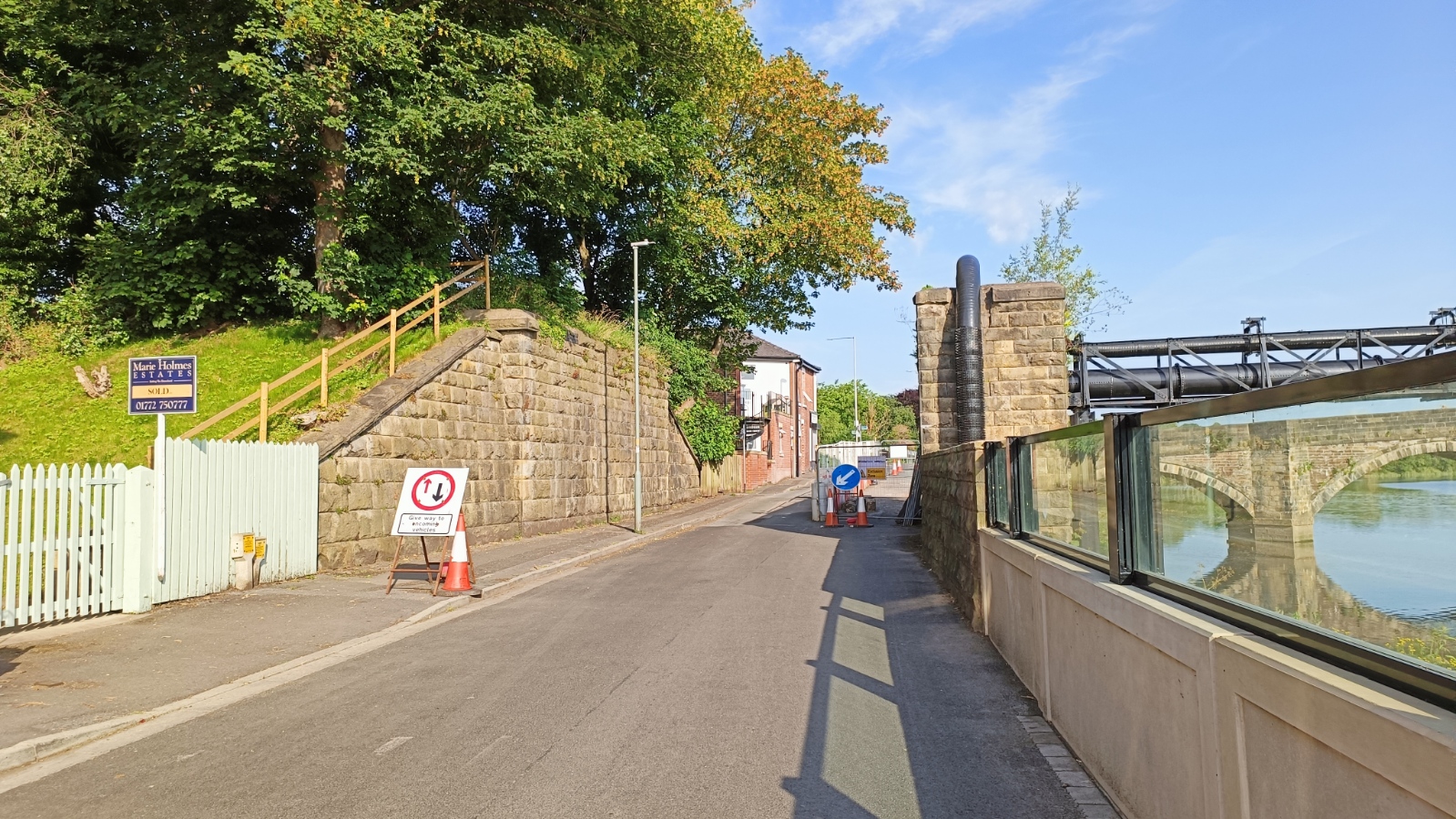
Out of the station, the railway crossed Riverside, and then the Ribble.
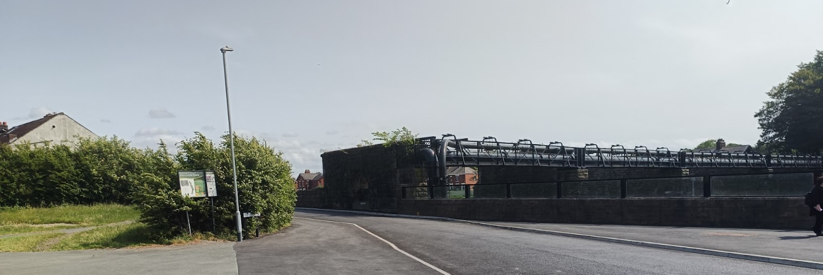
The bridge has mostly gone, but the piers are still there to support a pipe, which I think carries gas, and was renovated just a couple of years ago, so is still in use.


Penwortham
It headed southwest, and crossed Leyland Road. The bridge is gone, but the abutments are still there.

There was a triangle allowing connection to the L&Y network, which passed under the LNWR line (now the WCML).

I am pretty sure there used to be an aviary here in the nineties.

We will backtrack for a moment. Inside the triangle is a trailer park and the main access is through what used to be a bridge on the south section of the triangle.

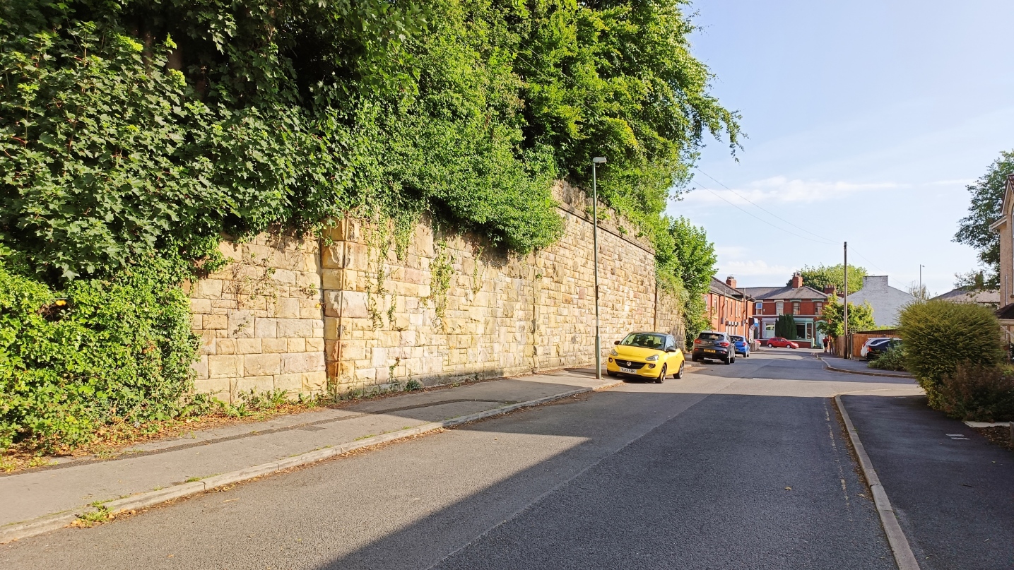
At the eastern point of the triangle, the two lines merges as they crossed Strickens Lane. Note how long the abutment is for the double track junction.
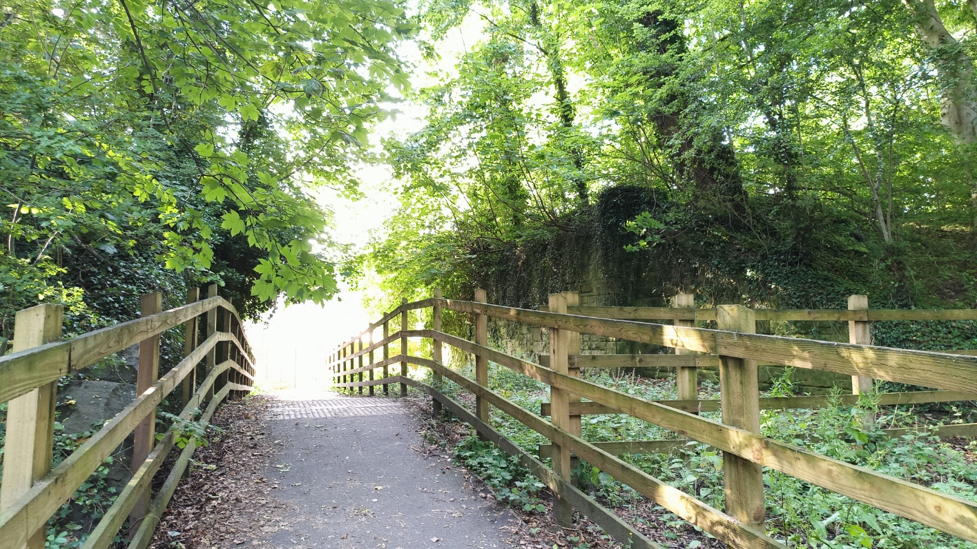
On the other side of the road, abutment and embankment have disappeared, as far as Leyland Road, but across the road, the embankment is still extant, and now a footpath.

This is where it passes under the old LNWR line.

Curiously tame squirrels along here...

Back to the Southport line... it continued straight, passing under Cop Lane, where there was a station. This part of the line is now the A59, as far as the Booths roundabout. This is looking back towards Preston from a footbridge over the A59 - the road follows the course of the railway as far as the bend to the left in the distance - the southwest point of the riangle we saw before.

This is the view from Cop Line, looking the other way, where the station used to be.

To New Longton


The other side of the field looking back.

There is a footpath from this point into New Longton.
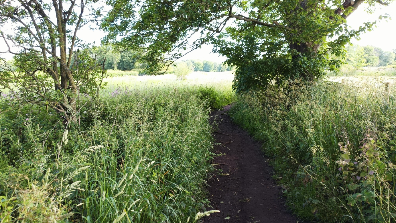
Past the Bowling Club, which is using the old trackway as a carpark.

To Station Road, where there was a level crossing. The house on the left was the crossing keeper's cottage, and the railway went through the house on the right.

There was a station, originally called Howick as there was nothing here, on the other side of the road, behind this shop. Now obliterated under a housing estate.

When the line was taken over by the Lancashire and Yorkshire, the station was renamed Hutton and Howick. A town grew around the station, and became known as New Longton, and in 1934 the station became New Longton and Hutton.
To the Rover Douglas

Then under Brown Hill Lane, and even the bump is gone, but just beyond you can see a line of trees where the line went.


It then went into Longton, where there was a brickworks as well as a station (called Longton Bridge for some reason), before crossing over Liverpool Road; the bridge abuttment is still there. The platforms went right over the bridge.

And then over Hall lane.

It curved back to the southwest, with a station at Hoole on Station Road, not especially close to Much Hoole.
It curved to the right to cross the River Douglas on a swing bridge; the parapet is still visible on the east bank. As far as I can see, this and the bridge over the Ribble were the only two bridges of note on the line.

Beyond the River Douglas

There was a short branch that headed south along the river, and connected to the Rufford Branch of the Leeds Liverpool Canal. It was open for passengers for just over a year, and closed altogether in 1930. The photo is probably more-or-less along the course of the track.

There was a station at Hundred End as the railway curved to go more southwestward. The station was to the west of the road, but the book office was attached to the signal box on the other side of the road. The station closed in 1962, two years before the rest of the line.

There is a ditch here, and I was not sure it was the railway at first, but old maps confirm it, and the ditch is called "Railway Ditch".
Southport

On the other side the bridge parapet is still there, but more housing estate where the track was.

The line from Crossans was electrified in 1904 as part of the service from Liverpool.
The line skirts the Botanical Gardens to the north and west. The car park is partly where the track was. This is looking back towards Crossans. The road from the left bends sharply to briefly follow the line of the railway, before bending back, and beyond that, you can see a gap between the houses.

The railway crossed a small river that runs through the gardens, curiously called "The Pool". It forms a lake in the gardens called the Serpentine Lake; it is definitely the river that is "The Pool". The bridge is still extant.

Beyond the railway was just farmland until around 1930.
There was another station, Churchtown, where the railway went over Cambridge Road. all that remains is the strange angle of the sides of the buildings either side of the road. The is looking northeast along the line of the track.

On the other side, shops now obscure the course.
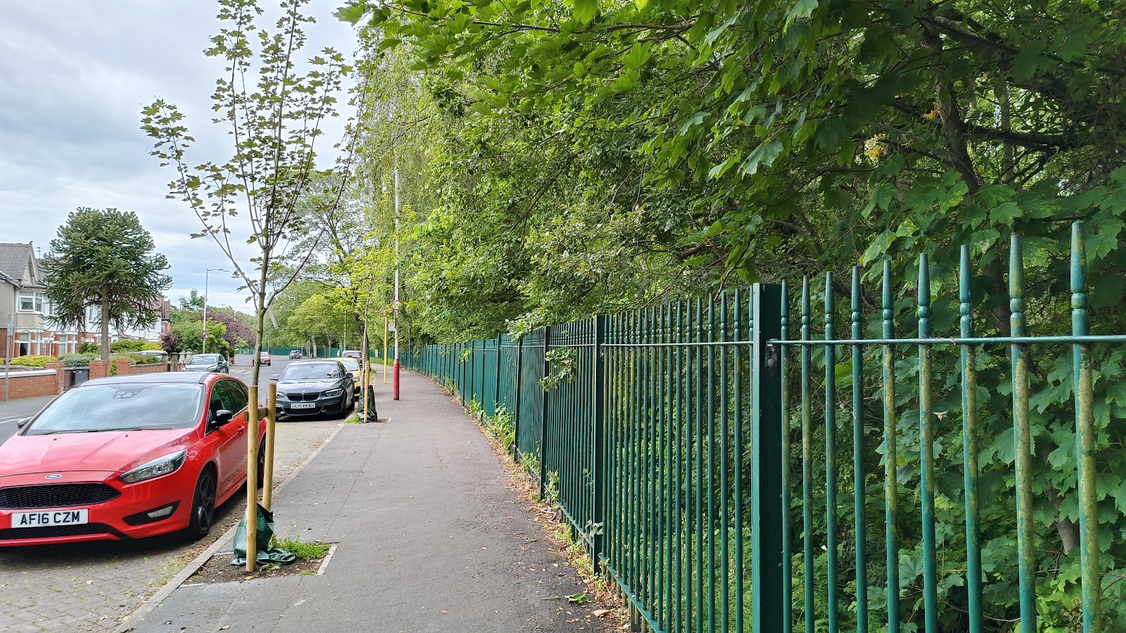
It went though suburbs, skirting Holy Trinity Sports Ground, under Roe Lane - the parapets are still visible.

Passing under a footbridge, it joined the WLR line to Liverpool at a triangle. This image is looking at the footpath where the footbridge used to be - you can just see the fence. The cutting has been largely filled in.

Moels Cop station is to the south east - which was also electrified at one time, with EMUs reversing both here and at Crossens. Electrification was removed in 1970. There was a carriage repair workshop inside the triangle to service the EMUs. There is a school there now.
This image shows the line of the west curve, heading to Moes Cop; the track was in a cutting to the right of the fence.
And at the end of the curve, Moels Cop station, with a surprising amount of weeds in the track.

It gets a bit complicated now... there were three railway companies who had lines from Liverpool to Southport. The Cheshire Lines Committee had Lord Street Station; easy enough. The L&Y had Chapel Street, and a line to Wigan, blue on the map. The WLR had Central station, and trains ran adjacent to the L&Y before diverging at St Lukes, with the Liverpool line heading first northeast before going south.

When the L&Y took over the WLR, they closed Central, and re-aligned the track so all trains went into Chapel Street. Blowick station closed in 1939, and that bit of line closed in 1965, so trains to Wigan start on the L&Y line, then go briefly on the last remaining bit of the WLR, before reverting to the L&Y.
This is the line looking back towards Preston from Hawkshurst Street. Where it curves to the right is where the line split off to Wigan. The Preston line continued straight.

Looking the other way, towards Preston, from the next bridge. Where the tracks diverge there used to be an island platform, part of St Lukes Station.

The station was accessed from the bridge seen in this photo. Again you can see the space between the tracks where the platform was.

There were further platforms for trains to Wigan behind where I took the photo from. This photo is of the bridge that once crossed that line. The buildings in the foreground are the local council highway depot; still used for the purpose well over a century later. At one time there was a siding to service it.

From the other side of the bridge. Again the tracks have diverged when they get to the footbridge. On the left, this is the connection into the L&Y line, and on the right the original line into the WLR terminus.

Nowadays all lines just go into the L&Y terminus, originally called chapel Street, but as the only survivor, it is just Southport these days.

The WLR line ended at Southport Central Station. Of the three termini in Southport, this is the least central, but I guess it is more central than the other WLR stations in Southport. Today the station is levelled and a car park for a retail park is on the site. All that remains is the name, Southport Central Twelve Shopping Park. Begs the question, where does the twelve come from?

By my estimate about 700 m of the WLR from Preston to Southport is still in use, from an original length of 24 km.


Great pics! Found this on your facebook post. You missed a few choice shots of the old line, the sides of the old bridge down Hall Car lane are still there and make a great shot. And if you go down Station Road from the Longton Bypass roundabout about half a mile, the old level crossing posts and part of the gates still remain, as does the station halt platform just beyond the gates, although this is well covered by brambles etc. Also, you have the pic of the old gantry taking the pipe over the Douglas but the line was actually further north and the east side bridge support and embankment is still in place. if a little crumbly. There are some great pics online of the old centrally turning swing bridge that once stood there. Do take another look, as these relics are well worth visiting and would add greatly to your blog. Kind regards, Chris M.
ReplyDelete