Moor Park and Environs
This follows on from my last post, which went up Moor Lane, and then back south down Lancaster Road South. This is what lies to the north and east of there, so we start by heading up the Garstang Road.
Garstang Road
At one time this was called Gallows Hill, as several men were hung here after the Battle of Preston.
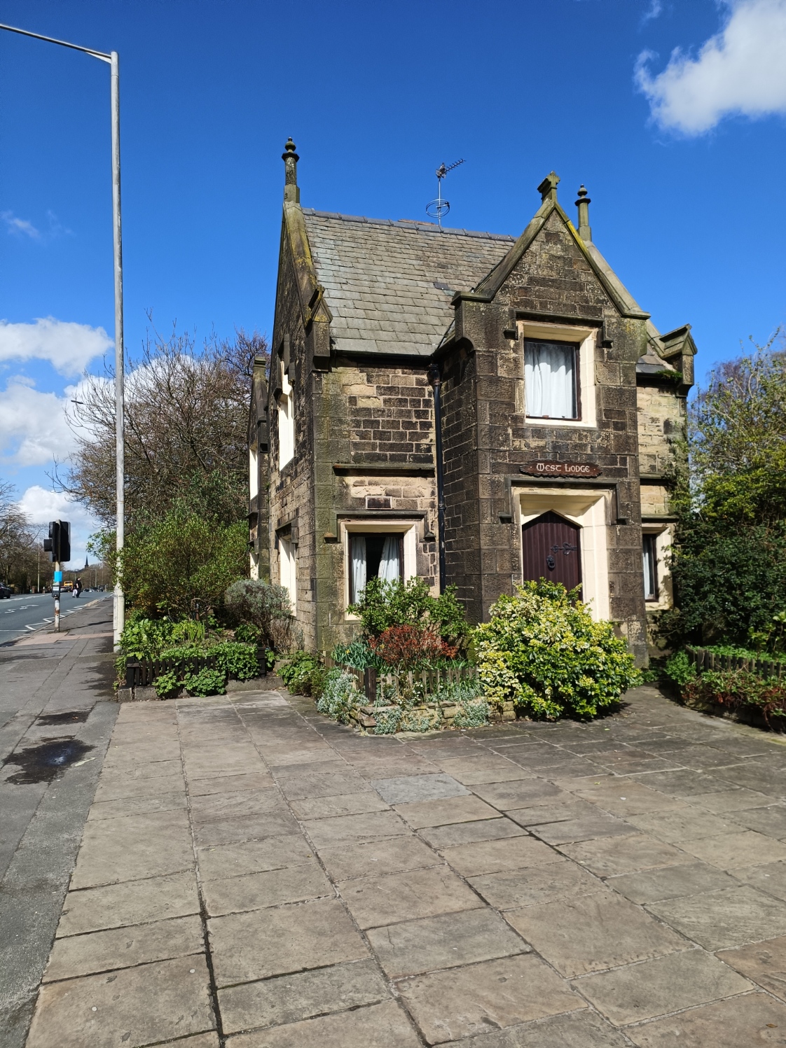
Immediately on the left in the Moor Park pub, on the corner with Aqueduct Street.

Obviously named after Moor Park, which was originally much larger - and came closer to the pub. Apparently it was the last pub in Preston to brew its own beer - though with microbreweries, I suspect that is no longer true.
There is a video of it from 1945 on YouTube here.
On the other side of the road is The Church of St Thomas of Canterbury and the English Martyrs, or just English Martyrs. An impressive building, this Roman Catholic church opened in 1867; old maps indicate there was previously a cattle market here!

This building at the back of it was a school for the church. The school is now some way southwest of here (behind "Urban Hub" if you look at my previous post).

Further up, on the same side is another impressive building. I think this was a Wesleyan Methodist church, though there is nothing on it to suggest it current status. It too had a school behind it.

Moor Park
When I first moved to Preston, I used to drive past it every day when I went to and from work, but it is only recently I got around to visiting it; today was my second visit. It is big, stretching across to Deepdale Stadium to the east.

At one time it was used for horse racing, and there is a stone there that marks the starting point/ When Radio One Big Weekend came to Preston, this was the venue.

And, more unusually, an observatory.

The Jeremiah Horrocks Observatory was built in 1927, and names after the so-called father of English astronomy, who was from near by Much Hoole (though Wiki tells me this is disputed). The opening coincided with a solar eclipse. The telescope inside is older, dating from 1860.

This is the south entrance, which takes us onto St Paul's Road.

Lovat Road


The only pub on the road was the prosaically named "Lovat Road", which closed in 2004, and was undoubtedly built as part of the terrace housing that extends beyond it.

Lovat Road becomes Charnock Street at the east end, and there is a pub, the Charnock, on a side road; also closed.
I wondered if this building was previously a pub, but after looking at old maps of the area, I suspect it is an old farm house called Charnock Fold (or part of it), which gives it name to the road behind it, and dating to earlier than 1850.

A little way down St Paul's is this building, which I think used to be a Post Office (the old map indicates there is one here, but not so clear exactly which building).
There was a church, St Jude's, on the other side of the road to the right, but nothing remains of that. However, head east from here (behind the photographer) is this, which was a baptist church at one time.
Not as impressive as English Martyrs or the Methodist church; I am going to guess it is not listed...
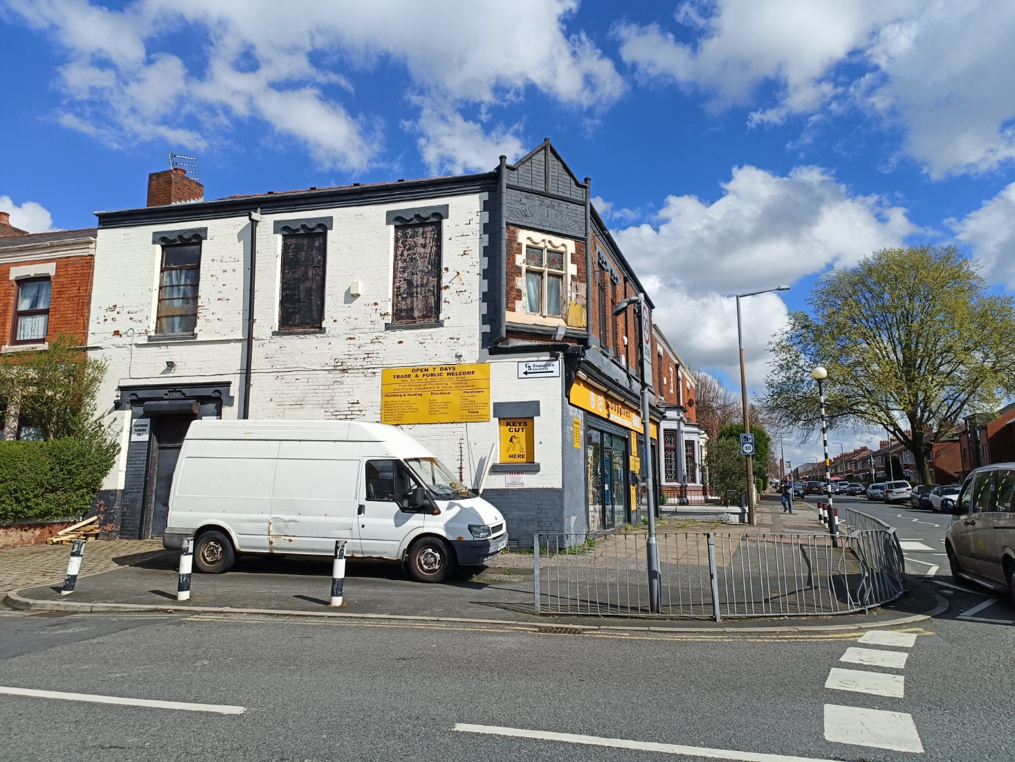
Further south down Kent Street, was the Duke of Kent pub, closed 2002.

The area beyond it was Hanover Street Mills, and across the road Kent Street Mill. The mills are long closed, and there is little housing in the area, and so the pub stands forlorn and unused. Some of Hanover Street Mills is still standing, but most of the mills in the area have been levelled.

Quite a contrast to the Park just five minutes walk to the north!


Comments
Post a Comment