Water Lane and Fylde Road
Water Lane rises steeply to pass under an impressive viaduct. At one time this was something of a focal point for Preston, somewhere for parades and the like. Nowadays, it feels like one big road junction.

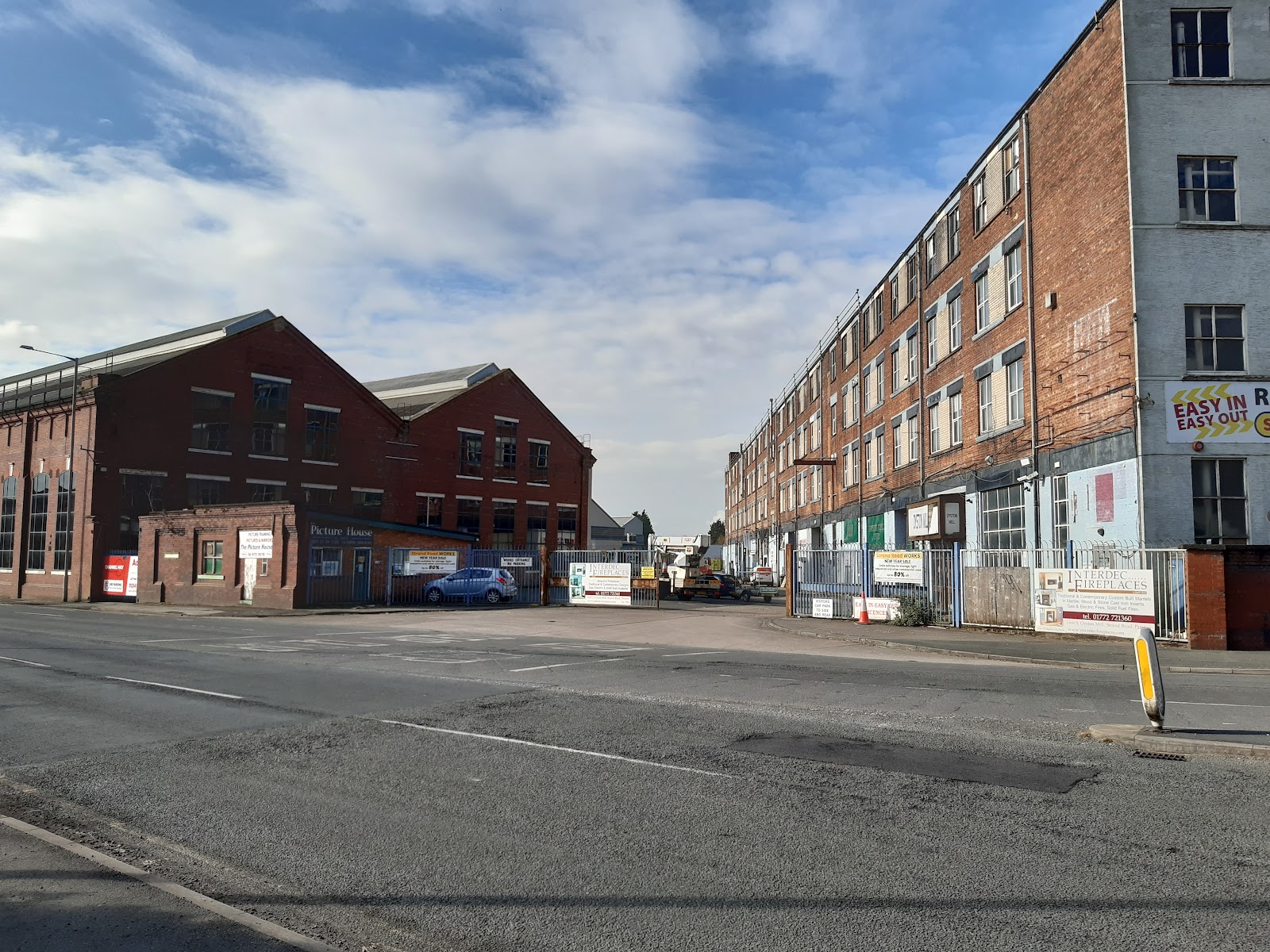
At the west end, where we begin, are Watery Lane and the Strand, and between them was an entrance to the docks. The photo below is looking that way, but I think was the entrance to Dick, Kerr, and later English Electric. The entrance to the docks was the other side of the building on the right.
A photo here shows how it used to look.
Back in the late forties there were two roundabouts here, as you can see here. I suspect the roundabouts were new at that time. Modern roundabouts are considered to date from 1966, so this was pretty forward-thinking.
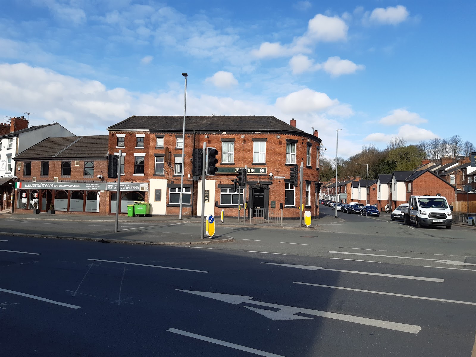
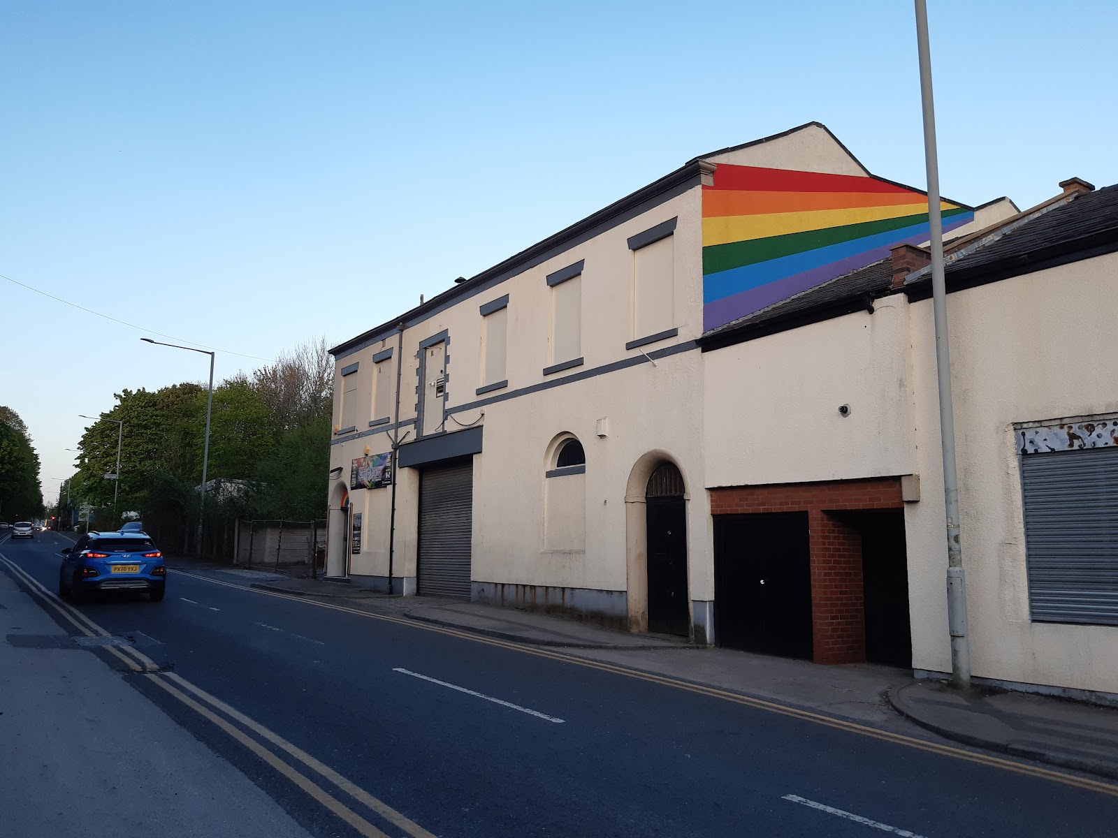
The first pub is called the Grand Junction. It dates from the mid-nineteenth century, so pre-dates the roundabouts by about a century.
The second, across Tulketh Road, is the Wheatsheaf. It was the Mighty Muldoons for a while, but has reverted to its old name. Wide busy roads make photography tricky!

Beyond the Wheatsheaf, Water Lane was originally quite narrow - and in fact I think this may have been the start of Water Lane. It was widened in the seventies, and I guess the roundabouts went then too. The demolished buildings can be seen here.
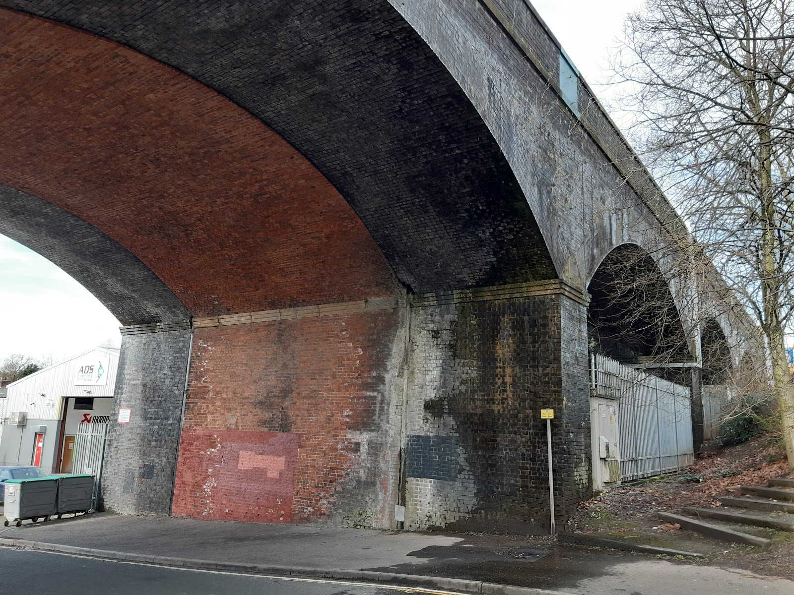
The viaduct takes the railway to Blackpool. The arch on the left was the only one that crossed Water Lane originally. When the road was widened, the second arch was used too, and all the houses on the right side demolished.

Originally double track, the viaduct was widened by extending the bridge on both sides, as can be seen from this view.
It is now back to just two tracks.
Just beyond, on the left, at the top of Water Lane, was the Fountain. It was demolished in the seventies when Water Lane was widened. There is an image here.
Water Lane continued for a short distance at one time, besides the canal.
Fylde Road starts at the top of Water Lane, heading into Preston through the university. The first pub, appropriately, was the Fylde Tavern.

Now a restaurant called Taboosh, and of all the conversions from a pub I have seen around Preston, this is the smartest. The old pub sign is still hanging, just visible at the back.
On the left is Aqueduct Street. At one time the canal crossed the street, hence the name; a very narrow bridge barely wide enough for one vehicle, so I am told. I imagine improving the road was the motivation for truncating the canal.
A short way up Aqueduct Street, beyond where the Aqueduct crossed, was the Lime House. This was more recently a Chinese restaurant, but even that has now closed, and been demolished.

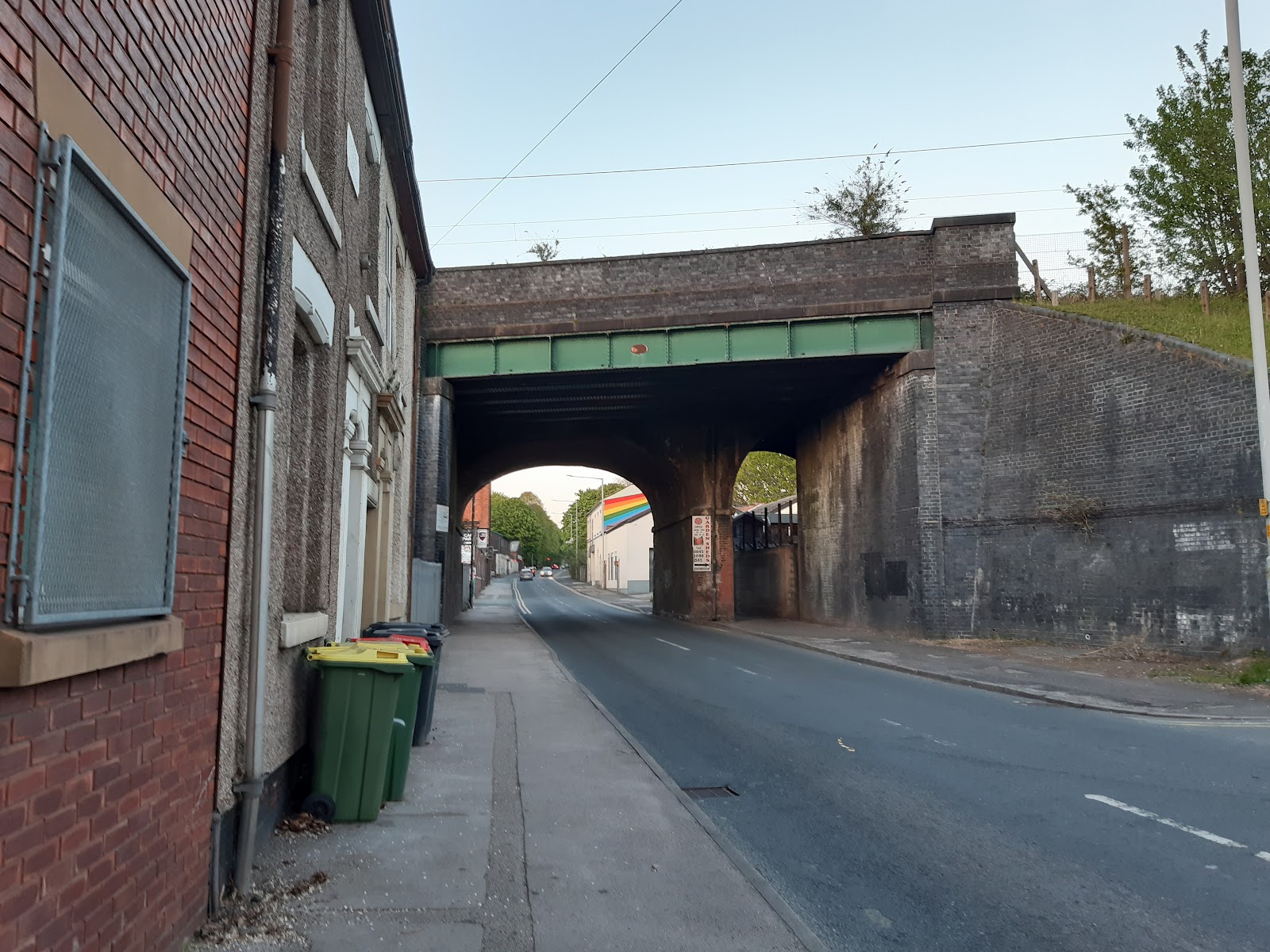
The road passes under the East Coast Mainline. The original bridge was two arches, crossed by two tracks. When the line was widened, an additional steel bridge was added, but it is only three quarters the length, so one arch is half obscured, making it look rather odd!
Curiously, I cannot find any maps that indicate is was ever more than double track.
A bit further on the left was the Prince Consort.

Back to Fylde Road, and after Aqueduct Street there was Doctor Syntax on
the right. Now a Chinese restaurant.

I think it was that colour when it was still a pub. The pub took its name from a famous racehorse... which begs the question, where did the racehorse get its name?
Opposite was the Grove (on Grove Street), and somewhere nearby the Brickmakers Arms, both demolished in 1962 under a compulsory purchase order. I suspect this was when the canal section was demolished, and Aqueduct Street realigned, and extended to meet Fylde Road.
Further on the right is Savoy timber, notable for the distinct building; it used to the Savoy Cinema.
Just before the bridge, on the right was the Princess Alexandra, also known as the Ole In Th' Wall and the Tap & Spile. Not an attractive building.


Just after Preston Tyre is a house that used to be the Watering Trough, it closed about twenty years ago.

The canal passed under the road here.

Gates on the other side, to the right of where the canal was, lead to a university car park; this used to be a railway goods yard that also served the canal.
Slightly further, still on the left I think was the Moss Rose Inn, closed in the fifties, demolished in the sixties, and behind it, the Greenbank Tavern, on Victoria Road, with a similar story.
We are getting to the university, and pubs that are still open!
On the right is the Guild, set back a little. The building dates from 1818, but has only been a pub since the eighties; originally the Hogshead, then the Guild Merchant.
[awaiting image]
On the left now is St Peter's Church, now an arts centre, I assume part of the university as there is a pretty ugly covered passage way from it to the student union.
The Ship Inn is now the Ship and Giggles.
[awaiting image]

Fylde Road curved sharply to the left, then the right to meet Friargate, though the University has had the roads realigned in the last couple of years... and still ongoing! The last pub, then, is the Adelphi.


As we get to the top of Friargate, there is the Lamb and Packet, but that is for another time.


Comments
Post a Comment