Anglezarke Reservoir
At last I come to the end of the Goit! The Goit flows into Anglezarke Reservoir, which is kind of the unknown cousin of the two Rivington Reservoirs, despite being the biggest. All three were built to supply water to Liverpool, though Anglezarke now supplies Wigan. All were built between 1850 and 1857.
Wiki tells us the parish of Anglezarke has a population of 23 (2001 census) - I probably saw more walkers than that. It looks like it should have a bizarre pronunciation, but apparently is just "angle-zark"
There is a cark park on the east side of the reservoir, towards the south end. There is virtually no signage to inform the public, and going along the access road is something of a leap of faith that you will not end up in a farm yard. When I arrived there was only one other car there - and there were a good dozen parted along the causeway on the way to it. The great advantage of the car park is the shade I could park my car in.
I walked all around the reservoir, going anti-clockwise. Clearly there will be a lot of photos of the reservoir...
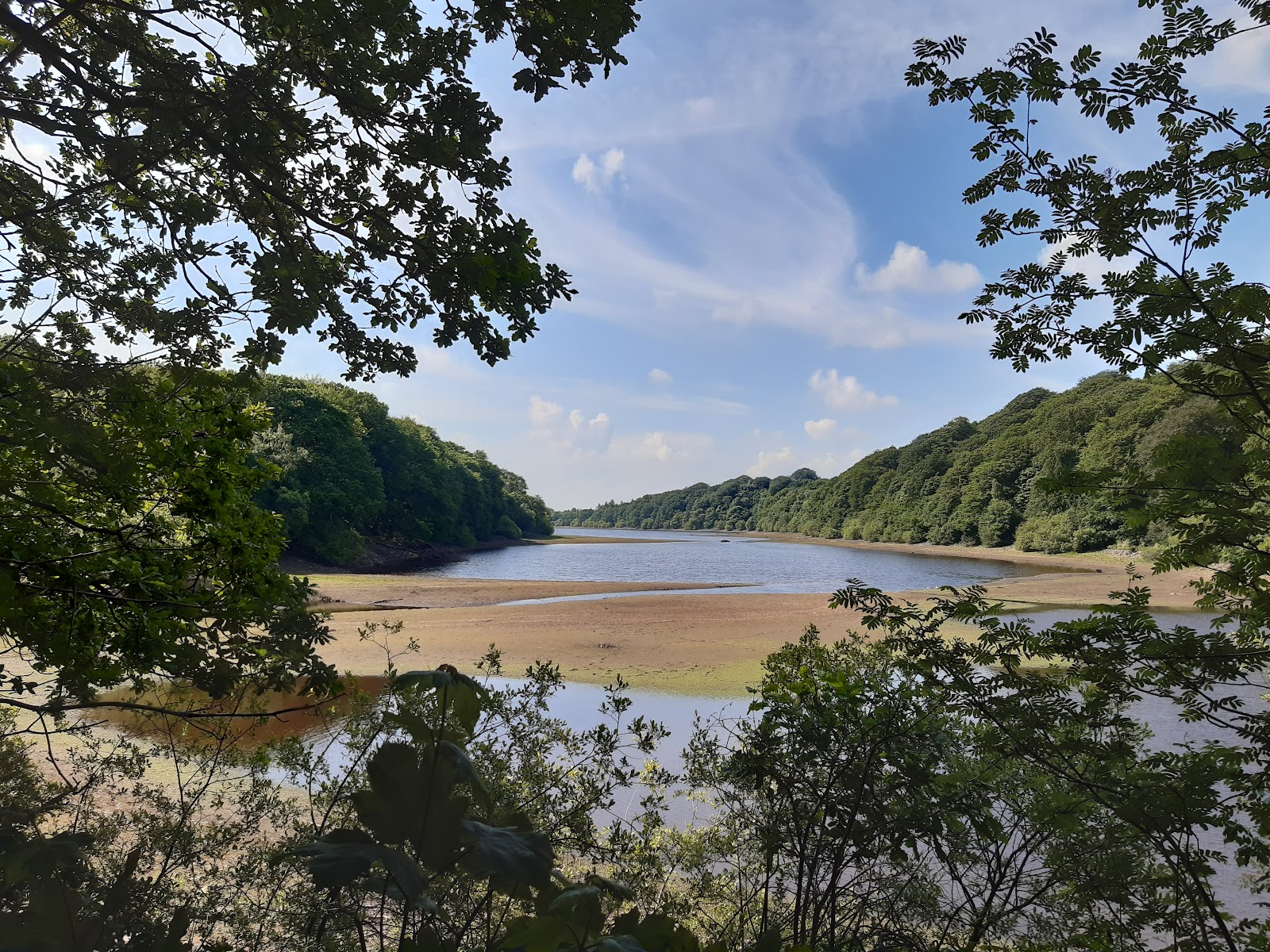
The walk heads off through woods at some height above the reservoir. A pleasant walk, but not great for photos, but occasionally the reservoir is in full view.

This next view is from the far side of the inlet seen above, looking down on the water.

Some way on, and a short way up the hill to the right is High Bullough Reservoir, which has the honour of being the oldest reservoir in the area, and was built to supply Chorley, being completed just as they started to built Anglezarke Reservoir. Water to Chorley flows under Anglezarke, as this web site explains. Not sure if it is still used - there was not much water in it.

Back to the big one, and the path emerges from the woods, though still some way above the water.

At the top of the lake the path joins Moor Road as it crosses the Goit, and after coming all this way to see it, expect a lot of photos... This is the bridge over the Goit, and is here mostly for the Rhododendra.

The view looking north to White Coppice, Brinscall and Roddlesworth Reservoirs, as described in ealier posts.

And down stream.

Just beyond the bridge is Heapey Waterman's House, a lovely Victorian mock Tudor building, built to house the man who helped maintain the reservoir.

The view looking down the reservoir.
The channel coming from the left is the outpouring of the Goit.
The road crosses a short embankment helping to contain the water of the reservoir; after crossing that, I turned left heading south down the west side. Looking back, you can see Heapey Waterman's House, with the Goit to the right.

The path down the west side was not so well made, but very much kept to the edge of the reservoir. It was also a lot quieter, I hardly some anyone, despite it being a bank holiday.


As you get towards the southern end, you can see Winter Hill, with the transmitter on it.

There is a long embankment to contain the reservoir, and you can walk along the top of it, but you need to go down before the end. There is a small car park; head for that, then left over the stile, then follow the path to get beyond the embankment.

Shortly after is the third embankment, used as a causeway for the road. This feels like the main one, as it includes the overflow and the supply for the River Yarrow. Looking north, up the reservoir.

The view the other way is mostly obscured by trees, but I could just see one of the Rivingtons.

I was then following the road back to the car park, crossing the overflow from yet another reservoir. This serves the Yarrow Reservoir, built in 1867 onwards, and might feature in later blog post..

The normal outflow from the reservoir is about 200 m further along.

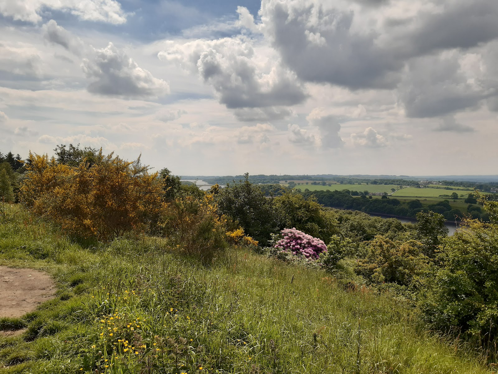
That completed the walk, but I took the opportunity to stop at a viewpoint somewhat higher up the hill, which gave great views of the area - I think I could see Preston way off in the distance. My phone does not do great distances justice, so I will finish with this one view from there, looking south, where you can see the two Rivington Reservoirs, separated by a causeway between them.


Comments
Post a Comment