Brinscall and the Waterfall
Brinscall is a couple of miles southeast of Abbey, where I was last week, and is on the route the Goit takes. This walk more-or-less follows the route described here.
The embankment in the photo below is the culverted Goit, taken from Railway Road.

Both Brinscall and Abbey were on the same railway line as Cherry Tree and Feniscowles where I was some weeks ago. There was a station at the north end of Abbey - called Withnell, which is a village between Abbey and Brinscall. The station building is still there, but I did not get to that end of the village.
The railway ran parallel to the Goit and Railway Road. There was a further station at Brinscall, just before the railway crossed the main road. The station has been levelled, the bridge and its approaches have gone, and the railway is now a walk, so nothing worth photographing. And that is not the walk I was doing.
At first glance, this village looks delightfully rural, but a look at maps from a century ago suggest the area was awash with industry. Abbey and Withnell both had their own mills, and the railway served a quarry just to the southeast that is still in operation. Brinscall also had a bleach factory and a print works.
The walk starts by the reservoir above the bleach factory, on Lodge Bank Road. The photo below shows the dam on the right; the factory would be further to the right, but there is no sign of it today.

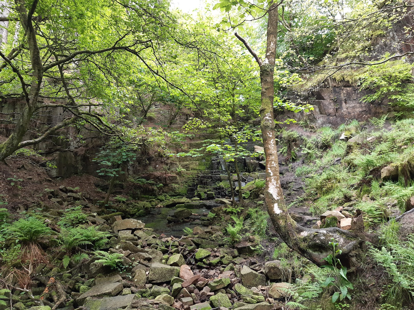
Crossing via the dam, I met the course of the Goit, which is still culverted at this point. There is a path that follows the Goit, but I crossed that, following Hatch Brook, heading to the waterfalls...
We do not have much in the way of waterfalls in the Preston area, and this was a major reason for this trip. However, the amount of water in the brook made me suspect it would not be that spectacular.

More bluebells, but these were the English variety.

The difference is that in the English variety the bells are all on one side, making the stem curve over.

The path to the waterfall is not easy. You have to cross the brook four times on makeshift stepping stones, and the last bit is pretty steep. You would want good, waterproof footwear on a day when there was a decent flow of water. And there really was not much water when I was there.
I retraced my steps back to the culverted Goit, and followed its course, heading south west. This was a much more gentle walk. It was not far before the Goit emerged.


It is quite a long climb up the hill - though a decent path, not like the track to the waterfall - and it takes you up onto what used to be a road to serve the local farms. The first of these was called Top o' th' Woods, and I think this is the ruins of the farm house.

Somewhat further, the remains of New Ground cottages.

The old road loops around the top of the water fall, this is the view looking down.

Shortly after this the old road meets Well Lane and a steep walk back to Brinscall, and another view of the reservoir.

This is popular with water fowl, including these four...

I think they are Muscovy ducks, which are originally native to the Americas - another invasive species! They are much bigger than mallards, and pretty inactive. I was parked not far from this spot and I am pretty sure they had not moved in the hour or so I was walking. When I drove passed, my car was less than a foot from the one that is stood up, and it did not move a muscle - it did watch me more carefully when I walked passed, so no they are not plastic models!


Comments
Post a Comment