Pleasington and Billinge End Road
This is a great walk that starts from Pleasington Station, going north, to Billinge End Road, with great views over Preston. It took me about 75 minutes, and is quite hilly. Not suitable for wheelchairs and pushchairs.
Just south of the station is the Railway Hotel.

However, we are heading the other way, north along Victoria Road, which, at the far end features another pub and the priory. The pub is the Butler's Arms, and seems to have closed.
I would guess it is named after John Francis Butler (or his family anyway), who, in 1816, paid for the priory to be built. Its full name is the Church of St Mary and St John Baptist.

Just beyond the priory is the old school building, where we turn right into Old Hall Lane.

I think the old hall is still extant, but beyond where I could get to on the lane. The public footpath goes left, heading north. There is a gate, chained shut, and access is via a style that is up the bank on the left and easy to miss.

It is possibly they were pregnant, and hence less active than normal, though at the end of April, they are pretty late...

Through the woods, and there is a very minor road to walk along, with occasional long views towards Preston to the left.
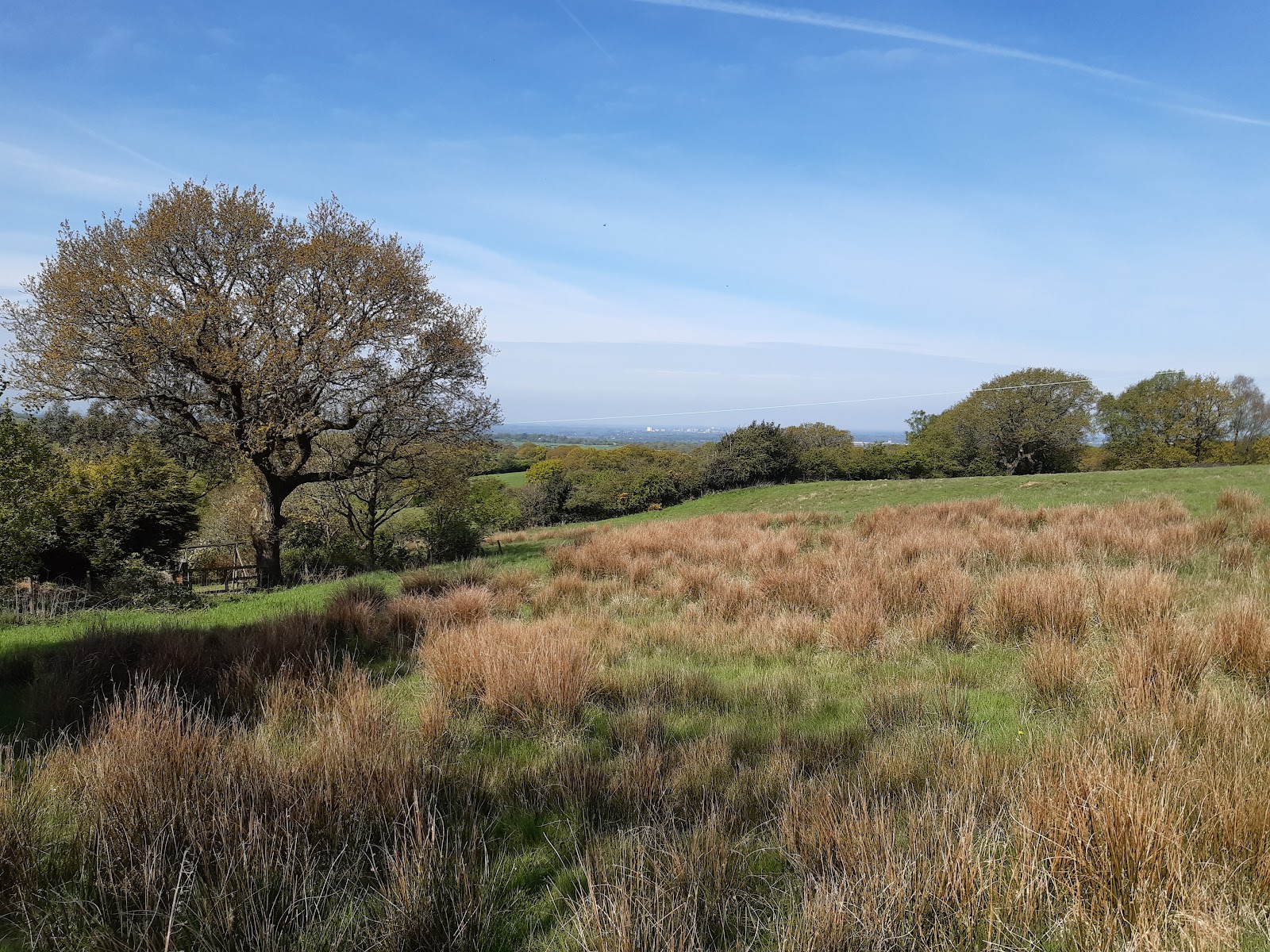
The road slopes gently down to Billinge End Road. It looks like the land to the north of the road is, or was, a country estate, and the gateway is still extant.

Continuing to follow the road, there are more views towards Preston on the right; my phone really does not do them justice, but Deepdale is easy to make out when you are there!

Perhaps you can spot it on this one. I think the hill on the left is where Houghton Tower is, though it is not visible.

A pretty pond on the left of the road.

Shortly after that, and you can see the valley of the River Darwen again. You can just about see the Jubilee Tower on the hill west of the town of Darwen on the skyline in this photo.


Down to cross Trout Brook. There is what looks like an aqueduct here. There are two aqueducts bringing water from the Lakes to Manchester, the Thirlmere Aqueduct to the west of Blackburn and the Haweswater to the east. This is neither of them...

After crossing Trout Brook, it is quite a steep walk back up to the Priory, and so back to the start of the walk.

The Railway Hotel was not so smart... It was clean, but had a rather more old-fashioned vibe. Quickly rather than quaint. I tried the Duffcocker, which I had not heard of before.

Pleasington Station is on the line from Preston to Blackburn. Given the size of the town, and how close it is to Cherry Tree Station, it is remarkable the station is still open.
I would guess it is named after John Francis Butler (or his family anyway), who, in 1816, paid for the priory to be built. Its full name is the Church of St Mary and St John Baptist.
Just beyond the priory is the old school building, where we turn right into Old Hall Lane.
I think the old hall is still extant, but beyond where I could get to on the lane. The public footpath goes left, heading north. There is a gate, chained shut, and access is via a style that is up the bank on the left and easy to miss.
A dirt track leads up to a small reservoir, past some very tired sheep...
It is possibly they were pregnant, and hence less active than normal, though at the end of April, they are pretty late...
At the reservoir, the track stops, and it is rather a leap of faith as you stride out across the field. There happened to be a couple walking their dog coming the other way, which indicated the route, though there is a sign in the trees to head for. If unsure, head for the highest part of the field. A stile leads into the woods. This is the view looking back just before using the stile.
Through the woods, and there is a very minor road to walk along, with occasional long views towards Preston to the left.
The road slopes gently down to Billinge End Road. It looks like the land to the north of the road is, or was, a country estate, and the gateway is still extant.
Continuing to follow the road, there are more views towards Preston on the right; my phone really does not do them justice, but Deepdale is easy to make out when you are there!
Perhaps you can spot it on this one. I think the hill on the left is where Houghton Tower is, though it is not visible.
A pretty pond on the left of the road.
Shortly after that, and you can see the valley of the River Darwen again. You can just about see the Jubilee Tower on the hill west of the town of Darwen on the skyline in this photo.
The lane descends...
Down to cross Trout Brook. There is what looks like an aqueduct here. There are two aqueducts bringing water from the Lakes to Manchester, the Thirlmere Aqueduct to the west of Blackburn and the Haweswater to the east. This is neither of them...
After crossing Trout Brook, it is quite a steep walk back up to the Priory, and so back to the start of the walk.
Addendum (05/Jun/24)
I re-visited Pleasington one Wednesday evening, this time visiting both pubs.
The Butler's Arms has re-opened, with an emphasis on food, and looked very smart inside. There were two beers on handpumps (well two that were on); I tried the Timothy Taylor Boltmaker.
It seemed to be doing a lively business for a Wednesday night.
The Railway Hotel was not so smart... It was clean, but had a rather more old-fashioned vibe. Quickly rather than quaint. I tried the Duffcocker, which I had not heard of before.
Again, a surprising number of people for a Wednesday night.


Comments
Post a Comment