History of Preston Dock and Quays
[Updated, Apr-May 2026]
At one time the Ribble, after passing under Penwortham New Bridge (the one at the bottom of Fishergate Hill), continued some way north, to about where the BMW showrooms are [now Chery showrooms], before heading west through Morrison's car park.
The dotted yellow line shows its approximate course.

There was a quay on the bend, later known as Old Quay, and a small tidal dock (about 100 m long), with a ship yard just slightly further down river, and the Ship Inn across the road from that. The road is now called Watery Lane. The Ship Inn was replace by the New Ship Inn, which is now Ignite.

This area was known as Marsh End, and was where the Moor Brook (also known as the Swansea Gutter downstream from around the Wheatsheaf) joined the Ribble.
A new quay, original called New Quay, but soon renamed Victoria Quay, was built, in 1825, a little way upriver, at the bottom of Marsh Lane, together with a warehouse, Victoria Warehouse, and an inn, New Quay Inn. The facilities, which included three "tipping machines" (I guess for unloading railway wagons of coal into ships) extended south to about where the sea scouts hut is now, and in 1846 was connected to the railways by the Ribble Branch Railway.
The region between the two quays was called Preston Marsh so was, I guess, unsuitable for building on.
This map shows the situation in 1844; the railway is already in evidence.
In 1861 plans were sought for a better solution, as silting was an on-going problem especially with ships getting ever bigger. Flooding was also an issue. The solution was to divert the river south and create a new dock, with a lock so it would not be tidal. Work commenced 1885.
River Diversion
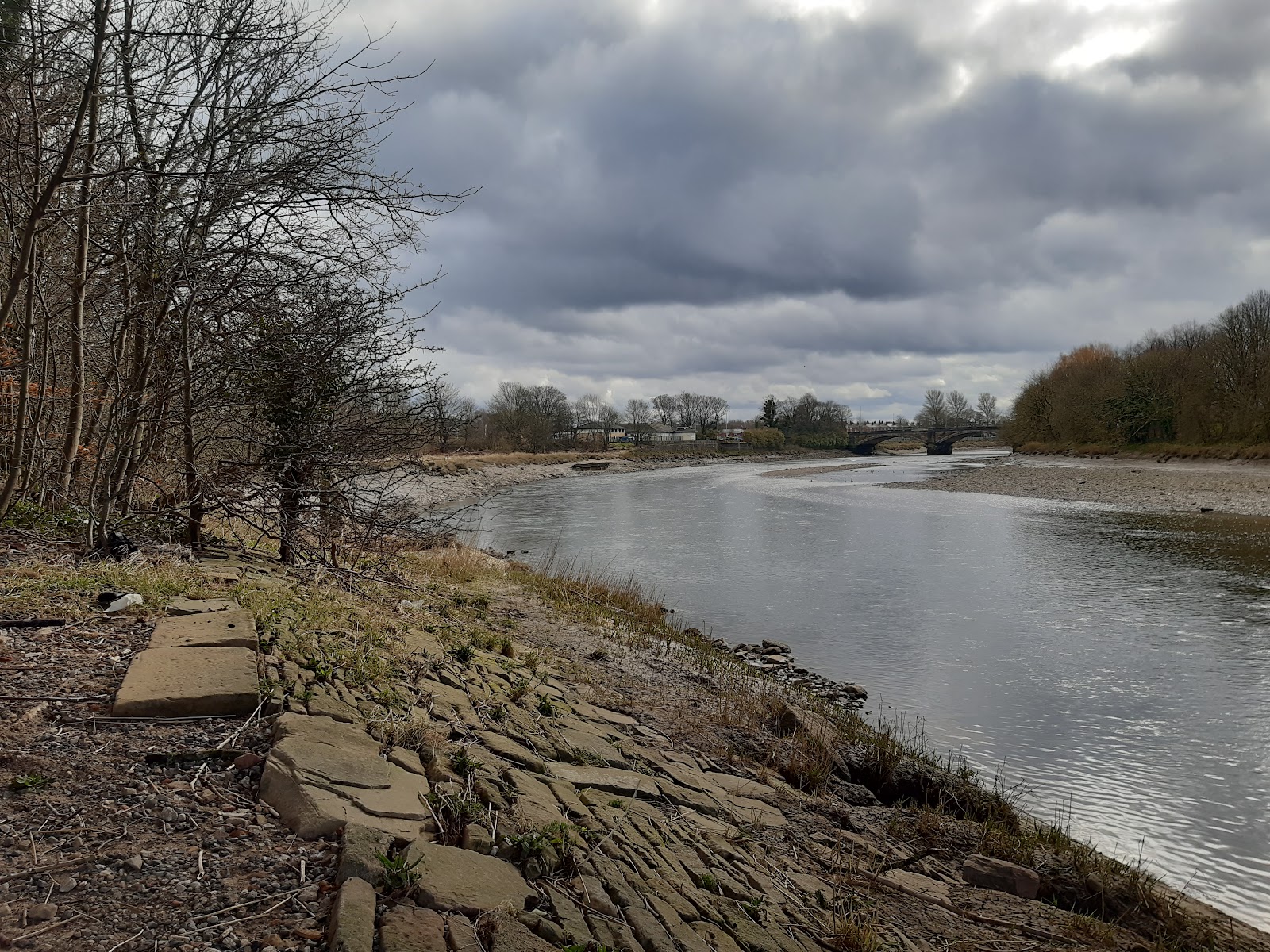
The photo below, taken from under the A59 bridge, shows the point where the river was diverted. In the upper half the river is following it original course, in the lower half it is following the diversion. The rock in the foreground is, I assume, part of the diversion work.
With the river diverted, the existing quays were no longer usable, and a temporary quay was built along the new diversion - the New Diversion Quay. The railway was extended to serve it.
This map is from 1890 - the new dock is there, with limited railways, but no facilities have yet been built. The New Diversion Quay is also visible.
The New Diversion Quay is still there - this is the view of it today. I guess the metalwork in the foreground was the footing for a crane. It looks like the quay was still in use in 1940 - and still called new!

Preston Dock
This photo is looking east from about the swing bridge.

This photo is from the north side, looking southwest; note the dragon-boat!

A siding from the dock crossed Watery Lane, to the timber yard there. The timber yard is now a building material supplier called Keyline - if you look at the wall at the front at the left end, you can see where the brickwork is different, presumably from when the siding was closed.

The docklands area has been significantly redeveloped, and looks very attractive nowadays.
According to here, the swing bridge is a relatively modern addition, built in 1984/5 to allow the north side of the dock to be redeveloped, but still give rail access to the west end. It is very unusual in that both cars and trains go over it.
Some of this information is from Wiki.
Railway
The rail system was quite complex, with up to eight locos employed to serve the area.
What remains of the railway is now a preserved line, Ribble Steam Railway, which is also unusual for carrying freight [sadly, that has now stopped]. Steam trains run Saturdays and bank holidays.

The freight trains bring bitumen from Immingham, at about 8 am on weekdays, as required. A pipe-bridge takes the bitumen from the rail tankers over Chain Caul Way to the plant.

Chain Caul Road
For many years I wondered where Chain Caul Road (and Way) got its name from. Is a "chain caul" some sort of dock facility? No! A "caul" is a jetty or fence that extends into a river for the purpose of diverting the flow to help keep the channel clear. Chain caul is the caul that was near Chain House, the house owned by the Chain family.
Chain caul was just east of the most westerly point of the railway. There is some kind of structure there, visible in the water when the ride is low enough.

Concrete Ships
Due to a shortage of steel during WW1, experiments were conducted on the use of concrete for ships (if that sounds strange, in WW2 the use of a composite made of 86% ice and 14% sawdust was considered).
There is some information here, though it says the ships were built on the south of the river, opposite the Bull Nose. This map, however, indicates it was on the north side, where the Ribble Steam station is today.
The photo below was taken from the Bull Nose. The slipways were just beyond the quay to the right.

Note the height of the electricity pylons in the background, sufficient to allow ships to pass safely under.
Dock Access and Associated Pubs
The dock area was accessed at two points, one corresponding to the Old Quay, at the bottom of Water Lane, the other corresponding to Victoria Quay, at the bottom of Marsh Lane.
At the latter, a second inn was built, the Neptune Hotel, the other side of March Lane to the New Key Inn. There is a photo of it in a very sorry state here. It was rebuilt I guess in the sixies? Apparently it was very popular with the workers at the factories on The Strand, but when they closed its days were numbered. It is now offices called called Neptune House [I think it might now be student accomdation].
It is, in my view, one of the ugliest buildings in Preston.

The New Quay Inn was demolished to make way for the new bridge over the Ribble.

Refuse Destructor and Sewage Ejector Station


From a map of 1892, it can be identified as a "Refuse Destructor and Sewage Ejector Station". I am not sure exactly what that is, but I wonder if the sewage that had previously emptied into the river at this point now had to be handled differently, given the river was no longer here, so it got pumped somewhere further away. The building says on it it was built in 1891, so the timing fits.


Comments
Post a Comment