Walton-le-Dale
Walton-le-Dale is just south of Preston. At one time the A6 passed through, before going through Bamber Bridge on its way to Chorley and points further south. It is mentioned in the Domesday as Waletune, become known as Walton-le-Dale (Walton in the valley) from about 1300.
Its big claim to fame is as the birthplace of textile printing. In the 1785s, Livesey, Hargeaves, Hall & Co had two mills in Walton-le-Dale, using a process invented by Thomas (some sources say Joseph) Bell. It appears the company over-reached (according to Wiki), and went bankrupt just two or three years later, owing £1.5M - a huge amount back then - and the bank they owed the money to went bust two days later.
It is not big - Wiki calls it a large village - but has a lot of old, attractive buildings, and is definitely worth a walk around.
We start from where the A6, London Road, crosses the Ribble
There was a pub here called the Bridge Inn (image here). It closed in 2013, and was knocked down, to be replaced by a nursery. All that remains is the post the sign hung from, just visible in the image below, with the bridge itself on the right.

There was a Roman supply depot just west of here, and it is noted on modern maps, but I have not been able to see any sign of it. There were gas holders behind the pub too at one time.
The A6 diverges to the west, just before, the Yew Tree, which now stands in splendid isolation in the middle of a road junction. An image here shows is as it used to be, near Flats Mill, and even older here.

Flats Mill was where the Capitol Centre now is, and took its name from the land there, so called because it is very flat, I assume.
The Victoria Road, the former A6, continues south, beside the river; this is the view looking east.

This water fountain was erected to celebrate Queen Victoria's jubilee, and is just a few steps further along the road. She seems to have had a big impact on the place, with two pubs also named for her.

The old police station is the first building on the left as we head into the village itself; it is now a residential property.

There are four surviving pubs, a surprising number given the size of the place. The first is the Sir Robert Peel, a rather plain building, named for the guy who invented the police. Is it significant it is opposite the old police station?

Next, on the left, is the White Bull, which looks the oldest, at the junction with Church Brow.


The Red Lion used to be on the right, just before the church.


We also get the view over the Darwen valley, which is less obstructed than the Ribble view, but not as spectacular.

The church in the valley is Our Lady and Saint Patrick. We head through its graveyard, to get to Higher Walton Road.


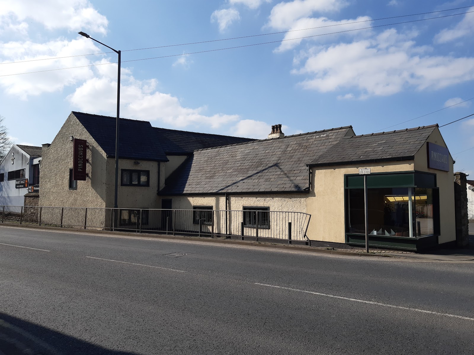
The Unicorn, which closed in the 30s, is now a restaurant called Pinochio's; an old picture of it can be seen here.
The road crosses the River Darwen, and after the bridge on the left is Walton Green, which runs along side the river, and has an impressive number of old, quirky houses along it.

Further down the lane, beyond the school is what used to be Walton Hall Farm, which looks to have been more of a country estate. There is still a farm, but several houses have been converted from the stables and lodge.

The path continues through the farm, and then under the A6, at which point you can see the Capitol Centre on the right. A small bridge allows you to cross the Darwen and head back to your starting point.


Comments
Post a Comment