Bamber Bridge
Bamber Bridge is only a few miles from where I live, but for some reason I have only been there a handful of times. I find it a fascinating place because of the wide variety of interesting, if not necessarily attractive, building down the main street.
It is odd in that it has only grown in one direction. The original village was where Ye Old Hob is, next to the A6. From there it spread northwards, up what used to be the A6, and is now the B6258.
That said, the nicest part is the short road east of Ye Old Hob, Church Road, which I guess was also the A6 at one time, but is now a cul-de-sac. This is St Saviour's church, which is officially in Cuerden.


The Old Hob, formerly the Black Horse Inn is at the corner of Church Street and Station Street.

Just south of that, Station Road crosses the River Lostock. This was (more or less) the site of the original bridge the town gets its name from.


The main street features numerous shops and businesses in a delightfully discordant mishmash of styles. One of note is Londis:

This is clearly an old building that was built as a shop. I very much suspect it was originally the Co-operative, as the side road is called Co-operative Street. The opening on the right side looks like is was an unloading bay originally.
A bit further north, this building is of note because of the strange angle of the left wall.

This was due to the course of the Old Tramway. I would guess the building post-dates the tramway, but the land deeds were by then pretty much set in stone, so it was built to allow for a railway that had closed decades earlier.
On the opposite to that was the Mackenzie Arms, built in the earlier nineteenth century, closed in 2008, and now demolished. It is just wasteland today. You can see a photo of what it used to look like here.
Heading further, we get to the level crossing on the railway line from Preston to Colne.

The signal box can be seen right of the train, sporting some very complicated steelwork that was put there just a few years ago to keep it upright. Presumably when it was built, there was not a lot of room, so it was constructed partly overhanging the track. The lopsided arrangement has eventually led to a tendency to lean towards the track. I think the signal box is still in use to control the level crossing.
The building to the left was the Lancs and Yorks, I guess taking its name from the company that used to own the railway. Since the above photo was taken (July 2021), a micropub has opened inside part of the old building, taking the original name.

Next, on the right, there was the White Bull, now an undertaker.

Further up, and we are getting towards what is today the centre of the town.
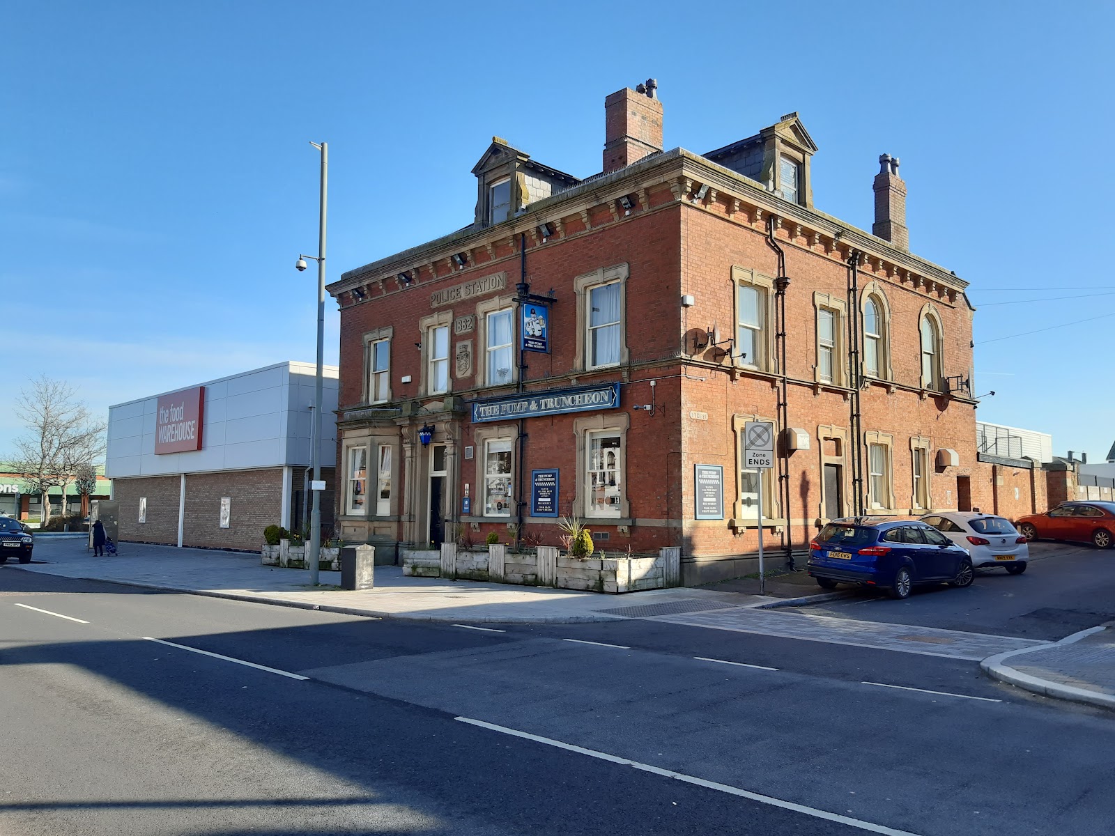
This is a pub, The Pump and Truncheon, a fine building that used to be the police station, and was built in 1882, as it proudly proclaims.
The other side of the road, and another new micropub, the Brig 'n' Barrel.
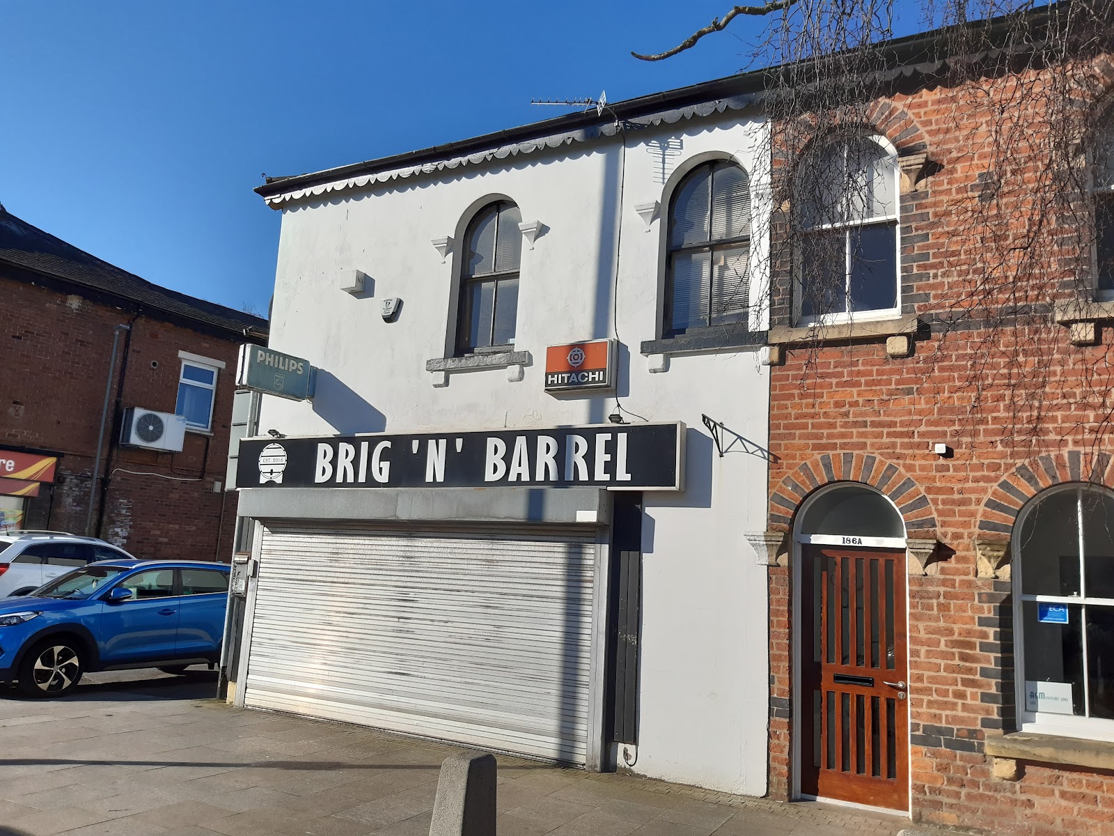
"Brig" is the local name for Bamber Bridge, by the way.
This end of the Bamber Bridge has had some attempts to improve it, at least with regards to the road and pavements. The buildings beyond The Pump and Truncheon on that side are all modern, and rather lacking in character. There used to be a cotton mill here, Withy Trees Mill.
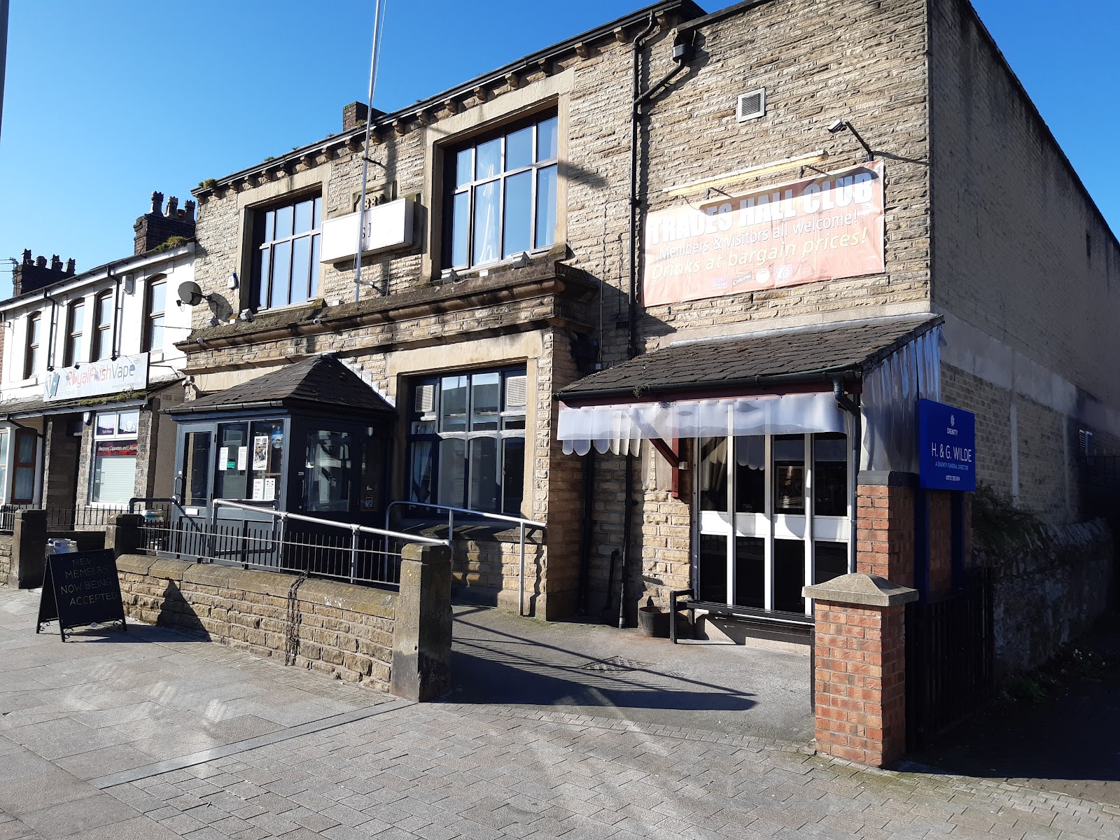
We do have the Trades Hall on the other side. This is a club, not a pub, but does seem to be open to non-members.
Next is Ye Olde Original Withy Trees, another old pub. Even in 1909 this was known as the Original Withy Trees - though in 1892 it was not a pub, if the map is right (it may not be, there is some evidence it was a pub from 1834).

As an aside, "ye" should technically be pronounced "the". the "y" is a stand in for the letter thorn, which is pronounced "th" and is no longer in the alphabet. Printers adopted "y" as the closest-looking letter.
As well as the Withy Trees Mill, there was a Withy Trees Farm on Brindle Lane (Back Lane at the time), and a Withy Grove, now Dovehaven retirement home, all pre-dating the name of the pub. A withy tree is a willow; withy was used for thatching and basket-making. Presumable this was a significant industry in the area at one time. This web page claims the pub was originally Withy Trees Farm, suggesting there were two of them, which is possible but seems unlikely.
We come next to a set of traffic lights, and, to the left, Brownedge Lane, which connects Bamber Bridge to Lostock Hall.
On the corner is the Withy Trees, now the Withy Arms. This is a relatively modern pub; I cannot find a date but from the style, maybe the sixties? I had assumed the name Ye Olde Original Withy Trees was a reaction to this, but the name predates this pub by a long way.

Heading briefly down Brownedge Lane... Brownedge is the name of the area before the A6, where we find St Mary's Roman Catholic Church.

St Mary's is notable for having a monastery, St Benedict's, adjacent to it. There was a convent too at one time. The monastery is not visible from the road, so no pictures.
The war memorial is here too.

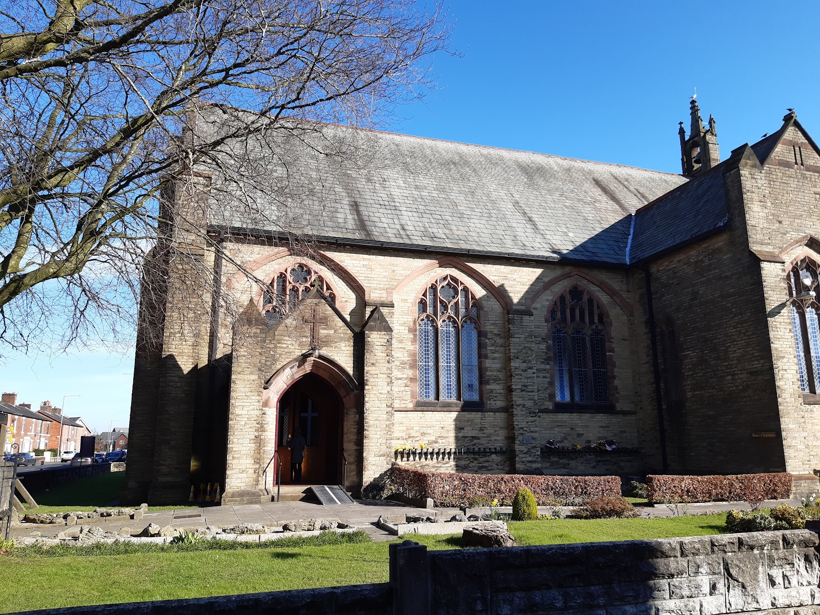
Back to Station Road, and over the traffic lights, and there is the Parish Church of St Aidan.
Shortly after that we get to the end of Station Road, where it meets Chorley Road, which heads to Preston (Chorley is the opposite direction), and, going east School Lane. At the junction is the Beam and Brycg. "Brycg" is an Old English word for bridge, while the "Bamber" of Bamber Bridge means beam, so the name seems to mean Bamber and Bridge.
It used to be the Pear Tree, which was much simpler.

We head now up School Lane, which was its own community back in the day, revolving around School Lane Mill. There is no sign of the mill now, but some old buildings are in evidence, like this one.

And this is the school that presumably gives the road its name.

Google Earth captures it (as of Mar/22) when it was having a fire put out!

At the end of School Lane is what used to be the Woodsman, which closed in 2009. It looks like a modern pub; it cannot have been open long at all.

Turn right from School, and we are heading southish on Brindle Road. Some way down, rather isolated from the rest of Bamber Bridge, is the Hospital Inn. This dates from early in the nineteenth century, and is seem open.


This is a brewery, but there is a bar too. Only open weekends I think, but you can check for yourself here.
Two last pubs I mention for completeness. These are modern buildings, styled to look old, and are either side of the A6, near Sainsbury's. To the north is the Poachers.

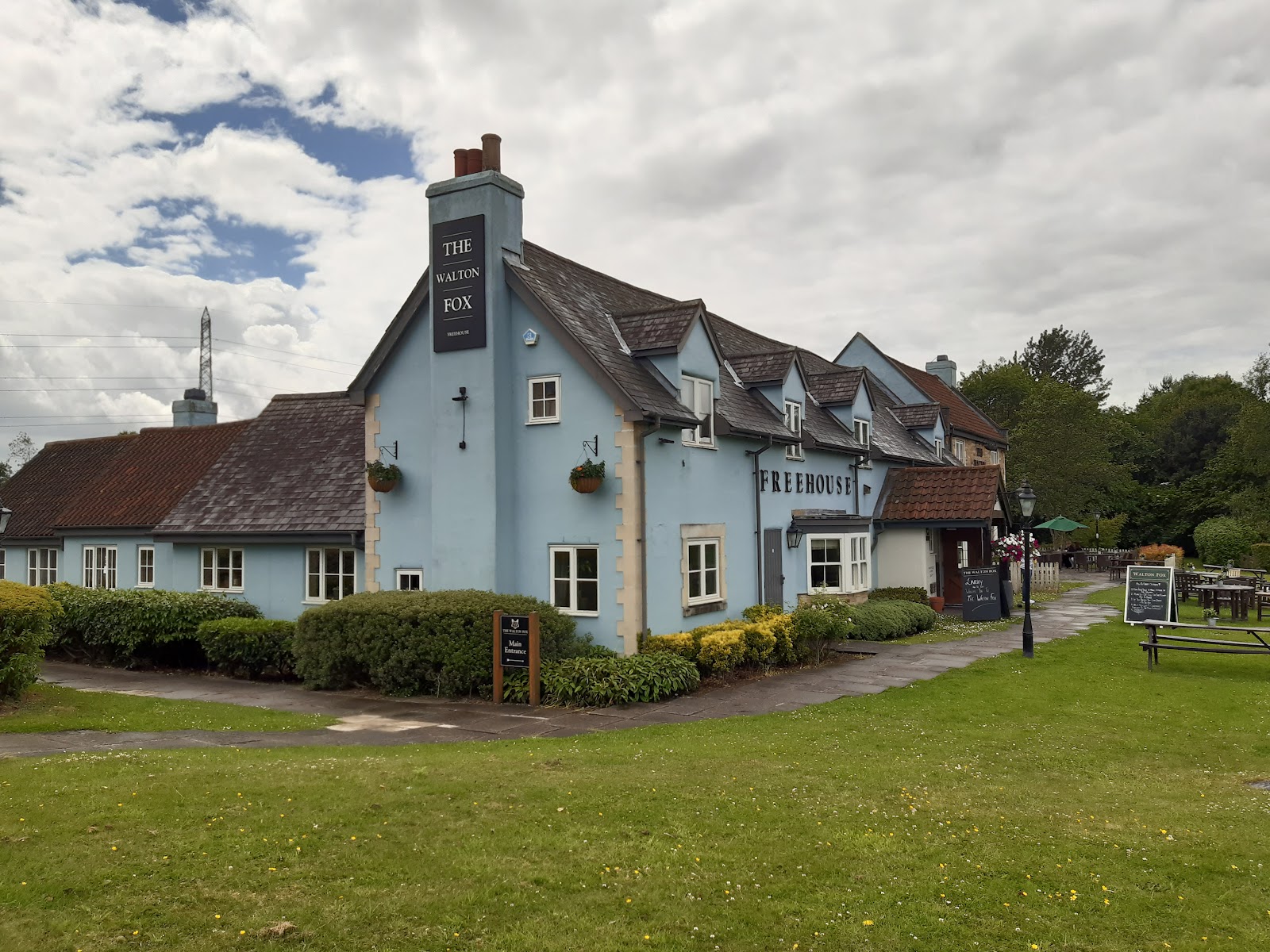
To the south is the Walton Fox.


Comments
Post a Comment