Bolton
Bolton is comparable to Preston in size, a population of 139k rather than 156k. Its proximity to Manchester makes it less important in an administrative sense - it is only a town, while Preston is a city - but as part of Greater Manchester there is a sense of it being a part of something bigger. It is notably bigger than the other towns I have visited recently. That said, like all the others, it is a mill town at heart.
It was served by two stations. Great Moor Street Station was built by the Bolton & Leigh Railway in 1831, connecting Bolton to the Manchester & Liverpool Railway. It passed into the hands of the LNWR, who moved it a little northwards, in 1871. It was only ever a terminus and it closed to passengers in 1954. Nothing now remains of it, it lies under Morrisons.
The second station, Trinity Street was built by the L&Y just to the east of Great Moor Street, in 1838, and was rather more successful, as it extended northwest to Preston, and northeast to Blackburn, as well as south to Liverpool and Manchester, offering through services to a range of destinations. Trinity Street station is still extant, though rather altered. The original station building was on the bridge, and was demolished in the 1980s, I assume so the road could be widened. All that remains of the original building is a clocktower, though it was moved to a new site.
This, then, is our starting point. The clocktower now stands just beside the modern station building. In this image you can see Trinity Court Church, which gives its name to the street, and hence the station.
A footbridge connects the station to a modern bus station, and this leads to the new name for the station, Bolton Interchange. Looks rather smarter than Preston's bus station!
Just beyond the bus station is St Patrick's RC Church. The stonework gives the sense it is very old, but it is Victorian, built in 1861. The road, by the way, is great Moor Street - the one the station was on, about 300 m southwest of here.
Heading west a short way, then turning right, there is a pedestrianised road, Newport Street. The shops along here are a little odd. They are all small, all the same size, all with the same surround and matching signs. I looks as though the entire street has been renovated in the same style, regardless of the buildings above.
Newport Street leads into Victoria Square, and the town hall, which opened in 1873. Considerably more impressive than what Preston has!
Across the square is the war memorial.
Behind the town hall is the impressive Le Mans Crescent. This was opened in 1934, and features a museum and art gallery at one end.
It only gained the name "Le Mans" in the seventies, and is because Bolton was twinned with the French town. I had no idea there was anything like this in Bolton - quite the revelation!
Back to Victoria Square, and this is the view looking back south. I have to say it makes a huge difference to a town's photos if the sun is out!
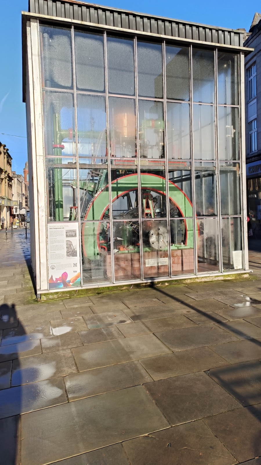
Continuing northwards, there is a monument celebrating Bolton's industrial past. This was actually in motion - though not steam powered anymore.
This brings us to Deansgate, and an Art Deco Greggs.
Going west along Deangate is this mock-Tudor shop. It was built in 1907, and was Whittakers department store, and later Beales. Apparently the timbers are authentics, being rescued from Tudor buildings being demolished at the time.
A bit further along on the other side is the Post Office.
Now going the other way along Deansgate, we see the Old Three Crowns. Hard to work out where the "Kitchen" next door stops and the pub starts.
This feels like the older part of Bolton, again something Preston does not have. At Bank Street, Deansgate becomes Churchgate. In the image, Churchgate, not surprisingly, is the road leading to the church.
I wonder how old the King's Kebabs building is?
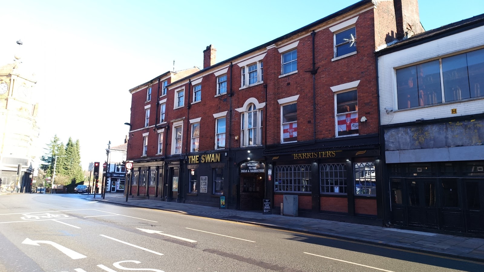
On the south side of Churchgate on the corner is the Swan; this is it from the south - you can see King's Kebabs beyond it. The oldest part - the bit you cannot see - dates to 1849.
Ye Olde Man and Scythe, which claims to date from AD1251, though rebuilt in 1636 is further along Churchgate. The text informs us James Stanley, seventh early of Derby had a drink here before being beheaded, which maybe where the name comes from.
On the other side is Ye Olde Pastie Shoppe. Built late eighteen century, so a mere youngster compared to the pub. There was already a queue at 11:30.
Looking back down Churchgate...
There are some more recent, and less attractive buildings, and then the church. This is St Peter's Church, Bolton-le-Moors, built between 1867 and 1871, the fourth on the site.
Back to where Deansgate became Churchgate, and now going south down Bradshawgate. This is looking back. Courtneys Bar used to be a bank. The brushes growing on the roof suggest it might not be a bar either now.
Left off Bradshawgate is a little gem called Wood Street. On the south....
And the north. Some of the building along here are listed, and date from ca. 1790.
Back to Bradshawgate, and on the right is Nelson Square. The statue is of Samuel Crompton, inventor and pioneer of the spinning industry and native of Bolton, who died in 1827; the statue was unveiled in 1862.
There is a Wetherspoons, the Spinning Mule, just out of shot to the left, and named after Crompton's most famous invention.
And that brings us back to the bus station!


Comments
Post a Comment