Glasson Dock
The village is, I think technically Glasson, but it is generally called Glasson Dock. It claims to have been the largest post in the northwest. I am guessing this weas pre- or very early industrial revolution, before the rise of Liverpool and before Preston eclipsed Lancaster. It still handles over 150,000 tonnes of goods annual, so I guess is Lancashire's biggest port today, give Liverpool and Manchester are no longer in Lancashire, and Preston is not used commercially any more. Quite something for a village with about 600 people!
The dock was built to serve Lancaster, as ships were struggling to navigate the Lune into the city itself. It was connected to the Lancaster Canal in 1825, though parliament had passed the plans for it more than 30 years earlier. A railway connecting it to Lancaster was built in 1883, but closed to passengers in 1930, and to goods in 1964.
It is a pretty place, and very worth a visit. The course of the old railway offers a nice walk.
The Village

Just beyond the church and to the left is the canal. This is looking east; the canal has to rise through six locks to reach the main Lancaster Canal.

In the other direction, the canal flows into Glasson Basin. The basin is not tidal, and today is used as a marina. This is a view of Glasson, looking across the basin.

I think this was part of the estuary, an inlet of a small river, to judge from a map of 1786, co-opted to form the basin.
The larger white building left of centre is the Victoria Hotel, a grade 2 listed building, but in a rather sorry state, and no longer open.

The road to the left leads to the East Quay, on one side of the tidal dock.

I think the dock has a gate which could be used to keep it full of water - opening only at high tide. This image from Google maps shows it was in use very recently, though not when I was there.

A swing bridge crosses the channel between the dock and the basin, over the lock. There is a cafe just beyond.

And the road goes up a small hill, past these attractive houses.

The view from the top of the hill over the Lune Estuary.

The big white building on the horizon is Heysham Power Station.
If we instead turn right at the cafe, you get to the Dalton arms. You really need to know it is there to find it - I used Google maps, and even then it directed me to the back of it.

However, if you do go round the back, you will find Lancaster Port Authority, which looks like the original building from when the dock was built.

The Walk


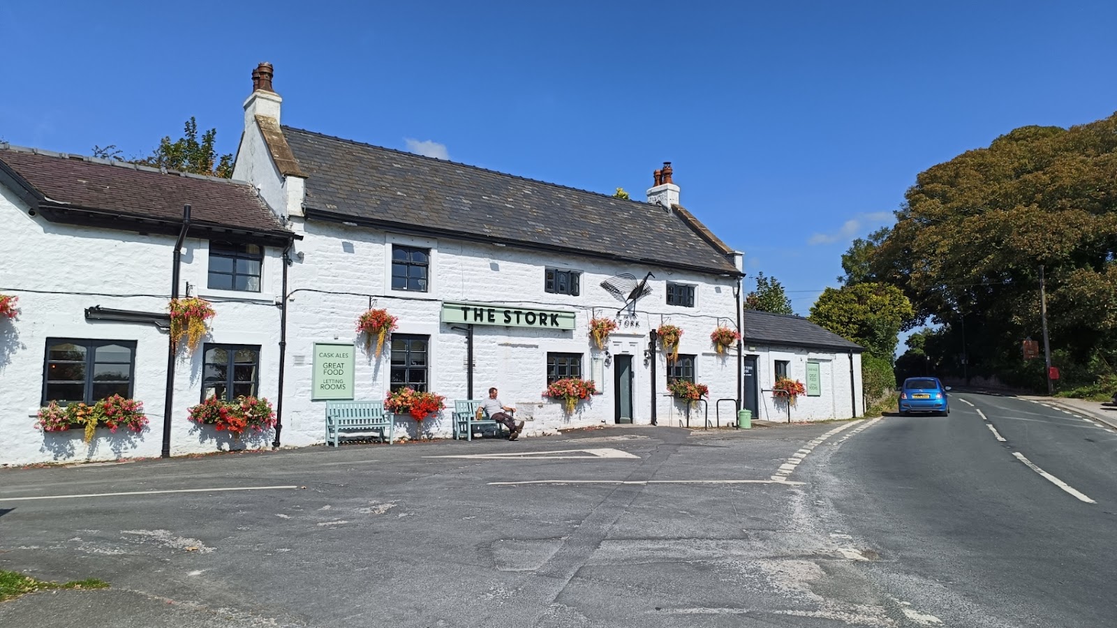
The road meets the A588, and there is a pub, the Stork, on the junction.
Walking along the road, you can see how much the River Conder meanders.

The road crosses the river at this fine bridge.

And at this point, we turn right off the A588. The road has some interesting views over the river. Here you can see the old railway bridge again.

And that brings us back to Glasson Dock!


Comments
Post a Comment